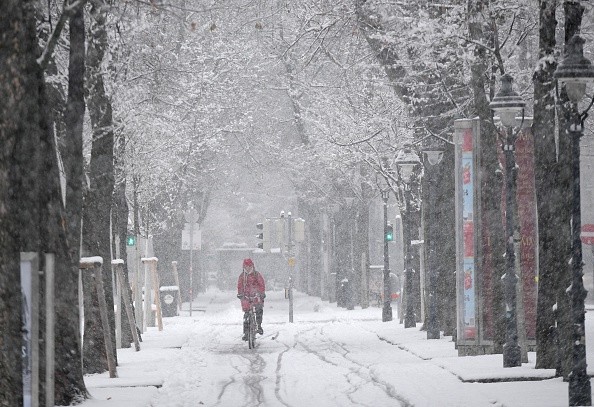
Through the middle of the week, the northern Plains will receive a dose of snow from a powerful storm that has already dumped several feet of snow in the Sierra Nevada of California.
However, snow won't be the storm's only problem, as AccuWeather meteorologists warn that the potent winds from the storm might increase the risk of fast-moving wildfires for regions farther south.
Snow in California
One of the country's busiest roadways was shut down for a period of time Monday night to early Tuesday because of snow from a storm in California. Donner Pass, California, Interstate 80 was blanketed with several inches of snow each hour, according to Accuweather.
As the same storm moves from California and Nevada to Utah, Colorado and Wyoming, it will bring with it substantial snowfall. There is a possibility of extra road closures in this area due to the severe weather.
This storm will not bring snow to Denver because it is traveling further north than the storm from last weekend. However, it will bring snow to the Dakotas and northwest Nebraska, as well as the northwestern half of Minnesota, on Wednesday and Thursday.
A senior AccuWeather Meteorologist says that this storm's fast movement and lack of moisture will generally limit the amount of snow to 1-6 inches with locally higher amounts.
Also Read: Meteorologists: Chances of White Christmas Across US is Changing
Freeze-up May Lead to Dangerous Driving Condition
This week's snowfall will be concentrated to the north and west because of the storm track. When temperatures fall quickly in conjunction with this storm, the roads and sidewalks under the snow may quickly freeze over, creating a slippery surface for drivers and pedestrians.
I-29, I-90, and I-94 in the northern Plains will be closed from Wednesday to Thursday because of the freeze-up, which will make the wintry accumulation more difficult to remove. Poor visibility is also expected, according to the forecasts.
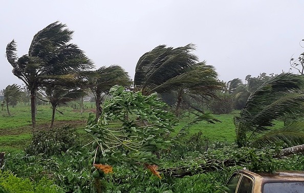
From the deserts of the Southwest to much of the Plains and Upper Midwest, strong winds are likely to be the storm's primary legacy.
AccuWeather Local StormMaxTM wind gusts of up to 120 mph are possible in the southern Rockies, which can easily flip over trucks, cause property damage, and lead to widespread power outages.
Regions Facing Wildfire Risk
As dry brush, dry air, and wind gusts combine, the central and southern Plains are at risk of wildfire. According to the United States Drought Monitor, soil and brush conditions in this area are abnormally dry to extremely dry.
High winds may carry desert dust hundreds of kilometers to the northeast. A few hundred feet of reduced visibility is possible in the most extreme cases of dust storms. However, in this case, the haziness of the sky can be a result of the dust in the air.
From Wednesday afternoon to Wednesday night, a squall line is expected to form over the central Plains, bringing strong winds and the threat of severe thunderstorms. It is possible that the squall line will be preceded by some tornadoes.
The dramatic temperature swings that have become the "norm" in the first half of December will come to an end following the storm. Instead, the northern half of the country will experience a fast west-to-east airflow for the rest of the month.
The pattern is expected to continue producing snowfall and brief gusts of wind as mild Pacific and cold Canadian air swap places.
Related Article : Developing Storm in Atlantic Coast Can Bring Strong Winds and Flooding in US Coasts
For more news, updates about powerful winds and similar topics don't forget to follow Nature World News!
© 2026 NatureWorldNews.com All rights reserved. Do not reproduce without permission.


