According to AccuWeather meteorologists, a wintry setup at midweek will deliver a period of precipitation from sections of the Ohio Valley to most of the northeastern United States, including some light snow along the Interstate 95 corridor. As the storm progresses, however, accumulations will vary across the region.

Another Storm
A separate storm, which dropped up to a foot of snow and sent below-freezing temperatures to the northern tier of the Central states on Monday morning, was now bringing frigid air southeastward over the Midwest. Early Monday, International Falls, Minnesota, was 5 degrees below zero Fahrenheit, with a wind chill of 32 degrees. The temperature was still hovering slightly around zero in the early afternoon hours. On Tuesday, the cold air will flood across the Appalachians and onto the Atlantic coast, though it will lose most of its bite as it moves eastward. Nonetheless, it will prepare the ground for winter rains.
Following highs in the mid-70s on Monday, temperatures across the Northeast will drop 20-30 degrees during the day Tuesday, with highs in the 30s and 40s forecast. Brisk winds will add to the cold, with temperatures in the teens and twenties.
Actual temperatures are expected to plummet into the teens and 20s over the interior Northeast on Tuesday night. Within a few degrees of freezing along I-95 cities from Washington, D.C., to New York City and Boston, just before a storm.
Related Article : Strong Weather Incoming, Storm Accumulates Snow Near Seattle
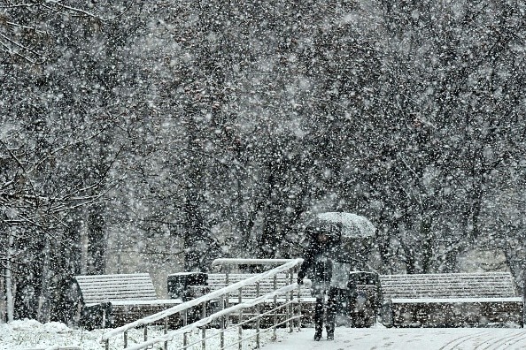
Snowstorm

The Northeast's upcoming snowstorm was moving onshore over the Northwest on Monday. According to meteorologists, the storm is expected to weaken significantly as it moves southeastward over the Rockies and Plains on Tuesday before turning slightly northeastward in the East on Wednesday. Because of its rapid track, the storm's ability to absorb precipitation from the Gulf of Mexico and the Atlantic Ocean will be limited. As the storm approaches the Atlantic, some last-minute intensification is conceivable.
According to Senior Meteorologist Brett Anderson, "the storm is anticipated to spread a swath of snow from sections of the Ohio Valley and the central Appalachians Tuesday night to the mid-Atlantic on Wednesday and then New England from Wednesday afternoon to early Thursday."
Even though snow may fall rapidly in a few spots for a short period, a large snow accumulation is not expected because the storm will move quickly.
"Where it snows Tuesday night through the first few hours of daybreak on Wednesday across the Ohio Valley, the central Appalachians, and maybe near the Washington, D.C., Baltimore, and Philadelphia regions," Senior Storm Warning Meteorologist Brian Wimer said.
Rain and Snow
Rain and sleet can mix with snow throughout the I-95 corridor from Washington, D.C., to New York City and Boston, and east at the East Coast beaches. Furthermore, air temperatures close to or slightly above freezing and somewhat warmer road surfaces may cause much snow to melt on the pavement. Accumulations on roadways are unlikely due to these considerations.
Flurries have only fallen in most of the main cities along I-95 from Washington, D.C., to Boston. Since official snow measurements are done on high, non-paved terrain, several of these communities may get their first 0.1 inches or more of season snow due to the storm.
On non-paved surfaces, a general covering to an inch of snow might build, and cars and pedestrians may experience slippery patches while traveling, particularly on bridges and overpasses, as well as in steep sections of the suburbs or further out countryside.
Snow and a wintry mix are predicted to cause flight delays in the region on Wednesday, necessitating aircraft deicing operations.
Air Cooling
The air and ground will be a little cooler further inland and to the north, and there will be more moisture in the atmosphere, bringing the chance of larger snow accumulations.
"Parts of southern Ohio, the West Virginia mountains, southwestern and eastern Pennsylvania, the Catskills in eastern New York state, and a region of central New England could get pockets of 1-3 inches of snow from the storm," AccuWeather Director of Forecasting Operations Dan DePodwin said.
Snow is predicted to fall Wednesday night into Thursday morning, resulting in a modest accumulation on roadways and slick spots in sections of southern New England before the storm moves out to sea.
On Wednesday night, another drop in temperatures across the area could cause untreated wet roads and sidewalks to freeze. Any surfaces that appear to be moist may be covered with a thin sheen of transparent ice, so motorists and pedestrians should be cautious.
There's a potential the storm may be so feeble or track so far south that it would only dump snow intermittently throughout the region. Even in the grassy portions of the region's higher altitudes, snow may struggle to accumulate much in that circumstances.
Expected Snowfall
The expected light to moderate snowfall might turn into a moderate to heavy snowfall event only if the storm develops and slows down enough. Because of the higher snowfall pace, temperatures would be several degrees colder in that improbable scenario.
Regardless of how much snow falls, the region will see the coldest air and most widespread cold weather of the season through Wednesday night. The majority of the cold air is expected to dissipate by the end of the week, but there might be another bout of snow or wintry mix before then.
For more news about the environment , don't forget to follow Nature World News!
© 2026 NatureWorldNews.com All rights reserved. Do not reproduce without permission.


