A storm will have burst into the plains by the middle of the week, bringing a threat of severe weather throughout the south-central states.
Development of a Potent Storm
Following a week of moderate and stable weather in the central United States, the Midwest and Plains will provide a breeding ground for the development of a powerful storm.
This storm will start its journey in the Pacific and will arrive on the West Coast of the United States by late Monday. By Monday night, it's expected to bring rain to California, Oregon, Washington, and southwestern Canada, as well as high-elevation snowfall to the Cascades and northern Rockies.
After this feature forms east of the Rocky Mountains, a swath of rain will continue to stretch over the Plains before colliding with chilly northern air.
As the storm approaches the Great Lakes region, this winterlike chill will allow for a transition from rain to snow on the storm's northern back edge, and a significant winter storm could form on the storm's northern side.
Rain and thunderstorms will likely extend farther into the Plains and perhaps the Mississippi Valley along the southern and leading edge of this powerful storm. Some of the storm-related thunderstorms may become severe.
The storm's energy, combined with the warm southern air, will cause instability along the rain and showers' southern leading edge. Thunderstorms may be heard from Texas to Iowa as early as Wednesday, before moving eastward.
Areas Windy Conditions are Expected
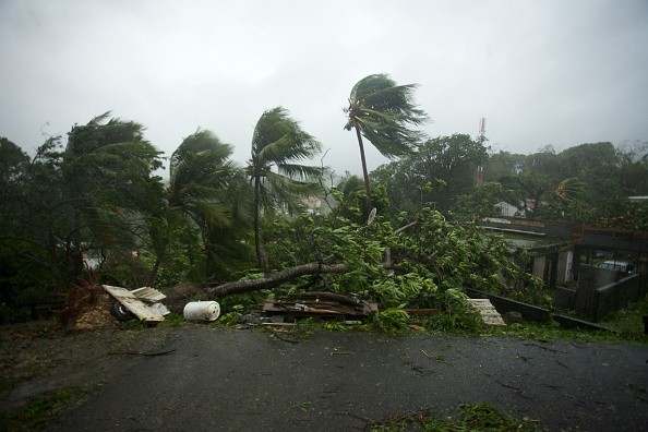
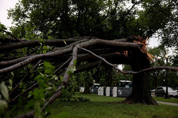
In addition to the storminess, this feature will be accompanied by an increase in gusty winds as it moves into the Plains. Beginning Wednesday, damaging gusts of up to 55 mph may be expected in areas east of the northern and central Rockies.
Windy conditions are expected throughout the Dakotas by Wednesday, including in Rapid City, South Dakota. Locations farther south, such as North Platte, Nebraska, may expect windy conditions by Thursday.
Mid-to-late week, downpours, strong winds, and snowfall may not be the only dangers hanging throughout the central United States. There is possibility of hail and tornadoes in addition to the heavy rain
The chance of severe storms will increase along the cold front as the storm moves slowly over the Midwest on Wednesday evening. Thunderstorms are expected to arrive in the Mississippi Valley during the midnight hours of Wednesday.
Rain and thunderstorms are forecast to move farther into the Mississippi Valley by Thursday, Veteran's Day, and showers are likely to move northward into the Ohio Valley. The storm's core will most certainly be focused over the Midwest by late week, accompanied by strong winds.
Potential Unsettled Weather to Impact the Midwest
As the week passes, there may be some changes in the thunderstorm's power. Whether the severe danger is localized or widespread depends on factors like how far south the storm digs and how much instability is accessible.
The storm's related cold front is forecast to sweep into the Northeast by Friday, bringing rounds of rain and colder air with it.
Forecasters encourage folks throughout the Midwest, Great Lakes, and Plains to carefully follow weather updates as the storm's precise path gets smoothed out in the coming days.
Some lingering moisture will be present across the Great Lakes and Northeast by next weekend. Forecasters are keeping an eye on the possibility of another round of unsettled weather hitting the Midwest by the end of next weekend.
Related Article : Major Cooldown and Severe Weather Conditions to Hit Central US
For more news, updates about severe weather and similar topics don't forget to follow Nature World News!
© 2026 NatureWorldNews.com All rights reserved. Do not reproduce without permission.


