Accuweather meteorologists are now keeping a close eye on U.S. coasts after the development of many tropical formations in the Atlantic over the last few weeks.
According to Senior Meteorologist Dan Pydynowski, "This is the time of the season that many of the tropical features have the potential to develop closer to the United States, either in the Gulf of Mexico, the Caribbean Sea, or western Atlantic." He also said that a good reason for the sudden shift is the gradual change in oceanic temperatures.
Actively Observing
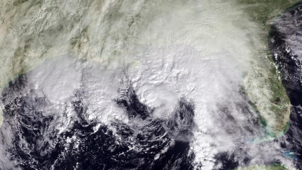
Meteorologists and other weather experts are now actively looking at any weather disturbances, especially those that will be coming close to the U.S. because the month of October is the third-most active period of the Atlantic Hurricane Season. In previous seasons over the years, many particularly strong hurricanes have developed during the month.
"Conditions will become more interesting in the western Atlantic over the next several days as a low-pressure north of Hispaniola gradually moves to the west and northwest," meteorologist Randy Adkins said.
Read also: Meteorologists Predicts that the Atlantic Hurricane Season Will Inevitably Be More Aggressive
Low Chance of Development
According to Adkins, chances for a new tropical depression or storm developing as of the moment is still considerably low because of the current conditions of the waters in the surrounding area.
"The wind shear, or winds disruptive to tropical development, in the low's path, is forecast to diminish some in the next few days, but may still be too strong to allow a tropical system to strengthen," Adkins said.
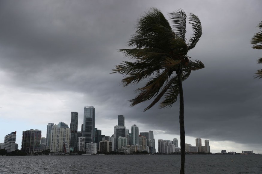
Another factor meteorologists think about is a sluggish front pushing across the southeastern U.S. right off the bat in the week. This front will probably pull tropical dampness from the Gulf of Mexico into the district, drenching regions affected by land-falling formations this season, similar to Hurricane Fred and Hurricane Ida.
Furthermore, the front could assist with upsetting enough of the environment to consider a tropical discouragement to frame in the western Atlantic.
Regardless of whether a coordinated tropical element creates, the tropical dampness shipped by a low will probably flood into the southeast Atlantic Coast in the not-so-distant future.
Tropical Developments
Tropical storms, while they could happen as right on time as the center of the week, might be more various toward the week's end when the center of the tropical low is probably going to move toward the coast.
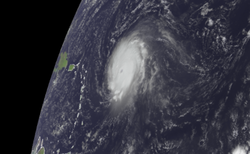
Forecasters keep on observing the potential for more tropical advancement somewhere else in the bowl, including close to Cuba, Jamaica, and into the Gulf of Mexico. Should another system reach hurricane strength essentially, with supported breezes of 39 mph or more prominent, it would acquire the name Wanda in the Atlantic Basin.
For more climate and weather updates, don't forget to follow Nature World News!
© 2026 NatureWorldNews.com All rights reserved. Do not reproduce without permission.


