In the Northwest, record-challenging dry weather and warmth have been predominant for almost all summer, but AccuWeather forecasters reveal a change in this pattern will finally provide some relief, meaning there will both lower temperatures and required precipitation.
Driest Spring and Summer in 77 Years
Since scientists started record-keeping at the Seattle-Tacoma International Airport, it has been the driest spring and summer ever witnessed in 77 years, as per National Weather Service. Just about 6.78 inches of rain has been estimated there since the 1st of March and this is the least amount of rainfall for that period on record.
In the region, that wasn't the only record set. There was rainfall on just 41 days over that same period of time. In the past, the least number of days rain fell in that duration was 46 set in 1951 and 1992.
In spite of a pattern change for the area, there is a possibility the dry streak will persist for Emerald City. Cooler air will be noticed in coastal locations, but rain could possibly still be at bay.
Alyssa Smithmyer, an AccuWeather Meteorologist said: "A pattern shift across the Northwest is expected as a dip in the jet stream shifts over the region."
The cooldown began on Thursday but will actually be seriously noticed by Friday.
Limited Rainfall
Smithmyer said on Friday, Eugene, Oregon, is predicted to attain a high of 73 degrees Fahrenheit and this kind of different from a high of 91 observed Wednesday.
Normally, on the 10th of September Eugene attains a high of 80 degrees. The region the cooler air will be easily noticed is farther to the north.
Smithmyer stated that "Seattle is forecast to drop to a high of 69 degrees on Friday, compared to Wednesday's high of 80."
This will make Seattle shift from a number of degrees above normal to a number of degrees below average, with 74 degrees as its normal high. In spite of the cooler air, little rainfall or even none is anticipated along the coast. However, the story will be different farther inland.
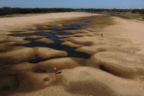
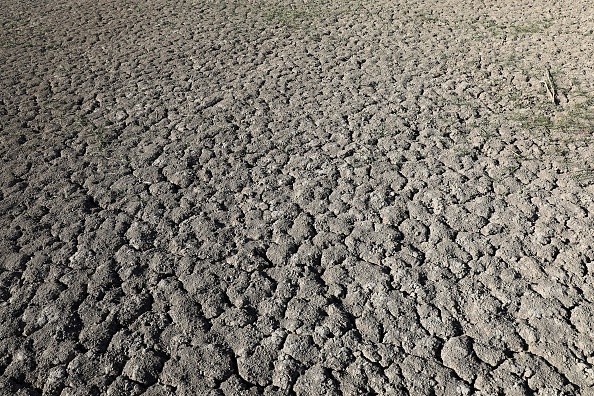
Exceptional Drought
A movement from the Pacific Ocean coupled with a ripple in the jet stream will get to the interior Northwest by Friday. Both features will prompt the development of a widespread area of precipitation.
Much of the area is in a serious drought, as per the United States Drought Monitor. Some places are even undergoing exceptional drought - the most extreme type of drought.
There is a possibility for 0.10 - 0.25 of an inch of rainfall to occur over many interior regions from the Oregon Cascades to Montana's Rocky Mountains. It is likely that some places could witness higher amounts locally.
Since August 21, Boise, Idaho, has not witnessed one drop of rain, but that streak could possibly end on Friday.
For more news, updates about drought and similar topics don't forget to follow Nature World News!
© 2026 NatureWorldNews.com All rights reserved. Do not reproduce without permission.


