
The Atlantic hurricane season was two weeks old on Monday, and the basin is already buzzing with activity. AccuWeather meteorologists continued to warn of the possibility of development in the southern Gulf of Mexico later this week as the second named storm of the 2021 Atlantic hurricane season formed off the Eastern Seaboard Monday night.
Tropical Storm Claudette
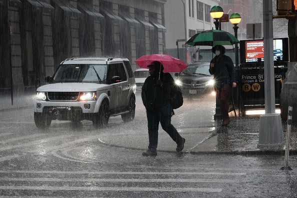
Whether or not a named tropical storm forms in the Gulf, forecasts warn that tropical moisture will arrive in portions of the southern United States that have been struggling with heavy rain and floods since May, potentially exacerbating the situation for hard-hit towns.
The disturbance in the Gulf has a high chance of developing, according to meteorologists. As a result, Claudette is the second tropical storm in the Atlantic hurricane season in 2021.
Rainfall totals could be an issue as we approach the weekend pic.twitter.com/tc9mdUGdfj
— NWS New Orleans (@NWSNewOrleans) June 15, 2021
A tropical storm warning has been issued for parts of the southern Gulf of Mexico. A tropical disturbance churning over the eastern Caribbean Sea on Monday is expected to meander toward the region around Thursday. However, if anything does form in the western Gulf, the chances of becoming extremely strong are slim.
Related Article : Tropical Storm Bill Forms Off the Coast of North Carolina
Wind Shear
Wind shear shifts in the strength or direction of breezes as altitude or a horizontal region above the Earth's surface increases. When wind shear is significant or rises with a storm's progress, the system might tilt, similar to a tree with inadequate roots. This leaning action can change the circular form of the moisture connected with the storm and, in some cases, can prevent it from intensifying.
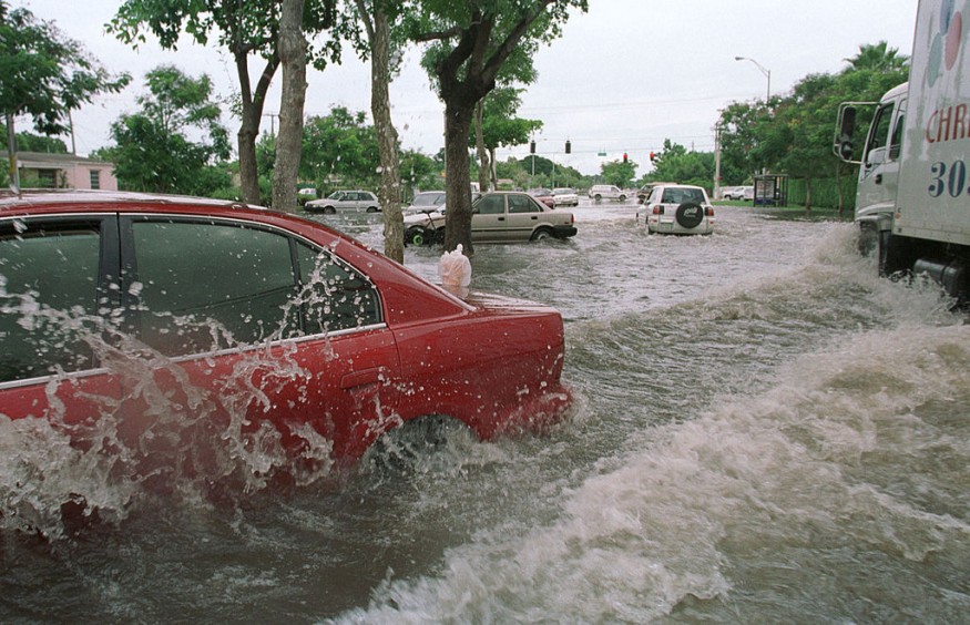
Even if the system weakens to the level of a tropical storm, heavy rain and significant floods can occur without the requirement for a catastrophic hurricane.
Because of the possibility of substantial southwesterly wind shear as this feature advances north, a swath of dry air may keep most of the rain away from the Texas coast, except for regions northeast of Galveston Bay.
Heavy Rains
Beginning as early as Friday, the plume of tropical downpours may be focused on Louisiana, Mississippi, Alabama, and the Florida Panhandle, perhaps continuing until early next week.
However, the amount of rain that falls and where it falls will be determined by the system's specific course and intensity. For example, a moderate tropical storm may concentrate heavy rain in a smaller region. Still, a poorly structured feature is more likely to disperse rain across a larger area, resulting in lesser precipitation accumulation in any one location.
More rain might fall over the central and northern Gulf Coast if the storm moves into Louisiana or southern Mississippi. A tropical storm approaching the Texas-Louisiana border, on the other hand, may bring heavy rain as far west as the upper Texas coast and primarily through southern Louisiana.
Although the quantity of rain expected is wildly speculative at this time, certain areas might see a foot or more of rain, with a general 3-6 inches of rain expected along and inland of the central Gulf Coast.
At the absolute least, a rainfall of this size, even if stretched out over a few days, would result in low-lying area flooding as well as street and highway flooding. In addition, rising floods could inundate some vulnerable towns by next week as runoff flows into local bayous and rivers.
Flooding
According to the National Weather Service, when significant rain poured over parts of the South Central states last week, certain rivers from northeastern Texas to northern Mississippi and western Alabama saw a rush of water that caused moderate to catastrophic flooding. The Sabine, Quachita, Big Sunflower, Big Black, Yazoo, Pearl, and Tombigbee rivers were all suffering major flooding in the South Central states.
Since the first week of May, areas close and just inland from the central Texas coast to southern Louisiana and sections of Mississippi have received 1-2 feet of rain or 150 to 200 percent of average. Ground conditions in these places and those in Arkansas and Tennessee to the north and Alabama and Georgia to the east are moist, making the region more prone to flooding.
Thunderstorms
Drenching rains and gusty thunderstorms will hit parts of southern Mexico and Central America this week before the system moves northward into the Gulf Coast. Forecasters warn of isolated flash floods and mudslides in some areas as a result of the developing system.
Meteorologists predict a highly active hurricane season in 2021, with 16-20 named storms and three to five direct impacts on the United States, in addition to the developing dangers in the Atlantic.
If Tropical Storm Claudette forms in the Gulf, it will follow Tropical Storm Ana, which formed in mid-May, and Tropical Storm Bill, which formed lately. The season's second tropical storm developed late Monday evening near the Atlantic coast of the United States.
For more climate and weather updates, don't forget to follow Nature World News!
© 2026 NatureWorldNews.com All rights reserved. Do not reproduce without permission.


