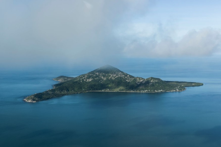
The geographical features of the northern part of the Lesser Antilles were revisited after Cenozoic deposits from South America were found in the Antilles islands off Central America. This emergence provided an assumption to researchers that the ancient fossils had gotten across several hundred kilometers of the Caribbean Sea via sunken islands or land bridge.
While it was hypothesized that the animals could have traveled across the sea through matted vegetation, the recent research backed up some evidence that moving tectonic plates and shrinking glaciers from over millions of years accidentally created a path for wildlife to travel over the American mediterranean sea of the Atlantic Ocean.
This paved the way to terrestrial faunal dispersals between South America and the Greater Antilles along the present-day Lesser Antilles arc.
The Controversial Biodiversity in the Caribbean
The Caribbean sea, known for its tropical ocean currents, as well as the Greater and Lesser Antilles on the northeastern fringe of the Caribbean Plate, have provided one of the most important centers and facilities for insular biodiversity, according to authors.
Although decades of studies had been done, it is still currently disputed how the sea held evolutionary development and diversification of terrestrial organisms.
The team modeled some 40 million years of tectonic plate movements across the junction between the Lesser Antilles, the Larger Antilles, and the Aves Ridge underwater mountain to demonstrate how landmasses were shaped and damaged once again.
They then figured the emergence and disappearance of these archipelagos and "mega-islands" might have been affected by the rise and fall of the sea level managed by glacial melt - one more thing the scientists modeled across a period of 1.5 million years. As chunks of glacial ice break off glaciers and floats into the ocean, the runoff significantly contributes to sea level rise as the amount of water in the ocean increases.
For further assessment, researchers used seismic data in the region gathered from over the last 40 years and current geography of the islands. Researchers matched island shorelines with a certain era when they would have emerged from and were able to work backwards to the late Eocene period.
Land Bridges in Antilles Region
The authors believe that the series of emergence relatively paved way to existence of episodic mega-islands and transient terrestrial connections between the Greater Antilles, the Lesser Antilles, and the northern part of the Aves Ridge (Saba Bank).
During the Pleistocene or commonly referred to as the Ice Age, maximum glacial stages formed the archipelagos and mega-islands repeatedly.
The idea of land bridges is more common than one might know, existing and disappearing for millions of years now. The landmasses in the Antilles region had been studied for decades although it was not as detailed as it should be. Researchers believe it has played a role in dispersal of land fauna during the last 40 million years, but more complete data is needed.
Researchers now aim to assess the region further through better paleogeographic maps and similar modeling techniques, covering the entire Caribbean Plate.
© 2026 NatureWorldNews.com All rights reserved. Do not reproduce without permission.


