Chunks of debris from a volcano eruption that caused a devastating tsunami in Indonesia a year ago were seen on the seafloor for the first time.
With the help of sonar equipment, the marine survey imagery shows parts of the strait between Java and Sumatra islands covered with triangular-shaped boulders, ranging from 70 to 90 meters high, that slid into the ocean from one side Anak Krakatau volcano.
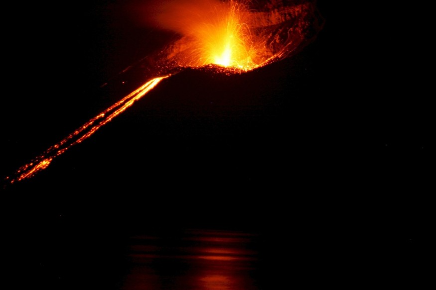
Anak Krakatau's crater partly collapsed after its December 22 eruption last year, with parts of it gliding into the sea and causing destructive waves that killed more than 400 people and injured thousands.
The Anak Krakatau volcano appeared at the site of the legendary Krakatoa volcano, which was destroyed after a massive 1883 eruption that killed more than 30,000 people.
Last year's disaster hit the region without warning, washing over famous beaches and overwhelming tourist hotels and coastal communities, and left a trail of death and destruction in its wake.
Researchers have been trying to mimic what occurred ever since. All their studies, however, have been based on what can be seen above the water.
Prof Dave Tappin and colleagues realized they had to examine the island volcano's missing section - now beneath the ocean's surface - or they would never truly see a full report of Anak Krakatau's collapse.
An international team consisting of members of the British Geological Survey, National Oceanography Centre, and various international researchers outlined the seabed with sonar technology using a multibeam echosounder.
Tappin, who works with the British Geological Survey, told AFP that tsunamis caused by very little volume landslides from active volcanoes like Anak Krakatau could destroy local coastlines and their communities.
The disaster revealed a rare appearance at tsunamis sparked by volcanic eruptions instead of more traditional undersea earthquakes, according to the team's previous study - which included work by Stephan Grilli at the University of Rhode Island.
Tippin told BBC News that early models of the collapse were based on satellite descriptions that only observed the Anak Krakatau's subaerial portions.
The British Geological Survey scientist noted the bathymetry imagery - at 200-meter water depths -showing triangular-shaped blocks, which formed before the collapse in the southwestern flank of Anak Krakatau.
Last year's disaster was Indonesia's third major natural disaster in six months, following a series of powerful tremors on Lombok Island and a quake-caused tsunami that killed thousands of people in Palu on Sulawesi Island.
"The event [proves] the [genuine] hazard from non-seismic tsunami mechanisms, and together with the Palu tsunami of September 2018, should be a [stimulus] for [enhancing] warning [signals] and mitigation from these events," Tappin said.
Next week marks the 15th anniversary of the "2004 Boxing Day tsunami," which killed approximately 220,000 people in nations around the Indian Ocean and affected Indonesia the most.
That tsunami - one of the most destructive natural disasters in history - was generated by a massive, 9.3-magnitude quake that struck undersea off the coast of Sumatra.
Indonesia, a diverse archipelagic Southeast Asian nation of more than 300 ethnic groups, is among the frequent disaster-hit countries because of its location within the Pacific Ring of Fire, where tectonic plates collide.
© 2026 NatureWorldNews.com All rights reserved. Do not reproduce without permission.


