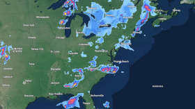
Snowy weather is set to return for the Western United States this week, marking the occurrence of winter-like weather in the region less than a month before the summer season in June 2024. According to a recent forecast by the National Weather Service (NWS), wet high-elevation snow and high winds will impact the West, including the Great Basin and the Pacific Northwest region.
The Western US weather forecast shows that the region is likely to experience heavy snow and relatively colder temperatures in high-altitude areas. Meanwhile, the weather service also forecasted critical fire weather conditions in the Desert Southwest due to windy and dry conditions. In addition, severe thunderstorms and torrential rain are expected across the southern-central Great Plains.
Western US Weather Forecast

(Photo : Photo by Girma Nigusse on Unsplash)
The NWS' Weather Prediction Center (WPC) issued its Western US weather forecast on Monday, May 6, showing heavy snow over higher elevations across the region will impact areas from the Pacific Northwest to the northern-central Rocky Mountains. The winter-like weather is caused by an upper-level trough associated with a weather front in the region, according to the short-range outlook.
The front moving over the West will contribute to heavy snow across the Rockies and Uinta Mountains on Monday. The early week period will see rain and snow developing over the Northwest as the system moves onshore, with increased snowy precipitation over the southern Cascades. Similar weather events are expected over the northern Intermountain Region on Monday evening.
The WPC forecast shows that the weather system affecting the Northwest starting Monday may impact the states of Washington, Oregon, and Idaho, as well as their surrounding areas. The US Government weather agency adds that the weather hazards linked to the system will continue at least on Tuesday, May 7, over the Northwest US, which may continue in the coming days.
Severe Weather Threat
The return of snow in the Pacific Northwest and other parts of the Western US is not the only weather headline for this week. According to Monday's NWS forecast, there is also a 'moderate risk' of severe thunderstorms over the central-southern Plains on Monday and a 'slight risk' across the Ohio Valley on Tuesday. During this period, heavy rain, large hail, and strong winds are possible.
However, the greatest threat from the severe weather is the occurrence of multiple tornadoes or a tornado outbreak within a short period of time. In April 2024 alone, the US recorded hundreds of tornadoes nationwide. According to the National Oceanic and Atmospheric Administration (NOAA), the US has higher tornado occurrences than anywhere else in the world.
Last week, a preliminary analysis by the NWS' Storm Prediction Center estimated that April 2024 incurred approximately 300 tornadoes, the second-highest on record. The persistence of severe weather in different parts of the nation coincides with the current spring season, which is set to last until the end of May 2024.
Related Article: Utah & Colorado Weather Forecast: Storm System Likely to Bring Scattered Showers, Thunderstorms
© 2024 NatureWorldNews.com All rights reserved. Do not reproduce without permission.