Maps
-
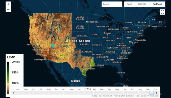
AI Predicts Wildfires by Mapping Dryness of Forests
Researchers from Stanford University are starting to use maps, satellite data as well as artificial intelligence to assist in predicting blazes as the West and California start heading into the season of wildfires as if the pandemic is not enough of a problem already.
most popular
-
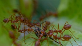
Fire Ant Outbreak: Invasive Insects Impacting Australia's Economy, Pose New Threat of Food Bowl Contamination
-
![Extreme Heat Wave in Africa’s Sahel Region That Killed 100 People Linked to Climate Change [Study]](https://1471793142.rsc.cdn77.org/data/thumbs/full/70226/280/157/50/40/extreme-heat-wave-in-africa-s-sahel-region-that-killed-100-people-linked-to-climate-change-study.jpg)
Extreme Heat Wave in Africa’s Sahel Region That Killed 100 People Linked to Climate Change
-
South-central US Weather: Floods May Resurface Due To Severe Weather
-
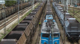
Coal Train Pollution Makes People Vulnerable to Hospitalization, Asthma, Heart Disease, Study Warns
-
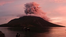
Remote Indonesian Volcano Spews Ash, Forcing Evacuations Near Eruption