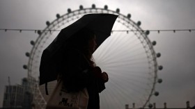
The violent weather system that spawned numerous tornadoes across the South and Midwestern US on Sunday was recorded from space by NASA satellites.
The National Weather Service's Storm Prediction Center counted 31 tornadoes Sunday, although that number may drop as data is refined.
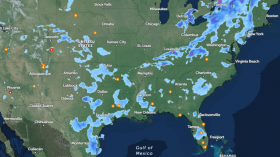
The massive storm system generated tornadoes in Nebraska, Kansas, Iowa, Oklahoma, Arkansas, Louisiana, and Mississippi, with central Arkansas being the worst hit.
At least 16 people were killed by Sunday tornadoes in three states as the region prepares for another round of severe storms Monday.
Initial reports in the aftermath of the storm cited 16 deaths in Arkansas, but that was later revised to 14 after authorities realized they miscounted, Reuters reported.
The same system went on to spawn a tornado in Mississippi on Monday afternoon, according to Reuters, which cited the National Weather Service, adding parts of Alabama and Georgia were also at risk from the storm system.
NASA's satellite imagery, which covers the hours between April 26 at 8:15 p.m. EDT to April 28 at 10:15 a.m. EDT, reveals the squall line of thunderstorms forming and the sudden outbreak of storms.
NASA's GOES-East and Aqua satellites were used to capture the data. GOES-East sits in a fixed orbit in space and collects data over the eastern US and Atlantic Ocean.
The Aqua satellites is equipped with the the Atmospheric Infrared Sounder (AIRS) instrument, which can collect temperature data.
Some of the storm system's cloud tops were as cold as 200 kelvin ( minus 99.6 F/ minus 73.1C), which indicates that the system had strong uplift.
Severe weather is expected to continue for several days in the Central and Southern US.
"This is a multi-day event and today is the second day of significant tornado risk and unfortunately, probably not the last," Bill Bunting, operations chief at the National Weather Service's Storm Predictions Center in Norman, Okla., told Reuters.
© 2024 NatureWorldNews.com All rights reserved. Do not reproduce without permission.


![Critical Fire Weather Forecast Issued for Great Plains, Red Flag Warnings in Effect [NWS]](https://1471793142.rsc.cdn77.org/data/thumbs/full/70269/280/157/50/40/critical-fire-weather-forecast-issued-for-great-plains-red-flag-warnings-in-effect-nws.jpg)