A severe thunderstorm threat will be likely in the Florida Peninsula this week, according to a National Weather Service forecast. Homeowners should stay alert for risks of lightning, tornadoes, hail, gusts, and rains.
In the latest NWS report, a few severe thunderstorms can unload in Southeast Florida this Monday, with potential hail and damaging winds. Heavy rain concerns were reported in the Southeast US and Gulf Coast last weekend due to a risk of moderate river flooding.
Additionally, a widespread chilly weather outlook could unload in the Mid-Atlantic and Midwest on Monday. People should stay alert for Freeze Warnings and Frost Advisories. With the colder conditions, damage to plants is likely.
Due to potential threats of severe thunderstorms in the Florida Panhandle, commuters should stay alert for challenging commutes, including flooded roads. For homeowners, the risk of tornadoes is dangerous, particularly at night.
Weather Outlook in Florida Panhandle
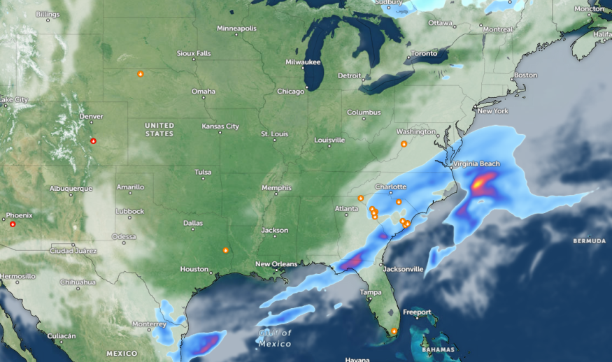
An NWS short-range public discussion monitors a front in the Florida Peninsula Coast, impacting parts of Florida on Monday afternoon. Residents should keep alert for showers with strong to severe thunderstorms.
The forecast issued a Marginal Risk of severe thunderstorms in the affected areas. Frequent lightning and hail conditions are likely, to affect the daily commutes in the Florida Peninsula.
Additionally, the advisory monitors the development of high pressure over the Middle Mississippi Valley and Southern Plains. Outdoor enthusiasts in the region can expect from five to 15 degrees below average from Northeastern to Southeastern US.
On the contrary, temperatures will be five to 15 degrees above average in the Southwest US. Meanwhile, rounds of rain will be likely in the Western Gulf of Mexico and Upper Midwest this week, bringing a risk of small flooding.
In Tampa Bay, special weather statements were issued in portions of Chiefland, Bronson, and East Bronson. Winds could reach up to 40 mph, with no hail expected. In addition, homeowners should stay alert for an approaching system in the region, which could unleash increasing storms.
In Miami, the forecast reveals that high temperatures can unload in the region, reaching from mid-80s to lower 90s. However, homeowners should still keep alert for a chance of isolated thunderstorms.
Central US Weather Outlook: Where Will Isolated Tornadoes Hit?
Central US can expect potential multi-day severe thunderstorms this week, with threats of flooding and severe weather. The poor weather outlook will start in the late week, particularly in the Plains.
On Thursday night, large hail, downpours, and isolated tornadoes are all likely. Winds can reach from 55 to 65 mph. The risk of severe thunderstorms is forecast in the following areas:
- Kansas City
- Dodge City
- Wichita
- Tulsa
- Wichita Falls
For Kansas residents, a chilly morning will be likely. In the early week, residents should monitor for Frost advisories in the region. On Friday, strong to severe storms could threaten.
Related Article : Mid-Atlantic Weather Forecast: Severe Storm to Bring Hail, Damaging Winds This Week
For more similar stories, don't forget to follow Nature World News
© 2026 NatureWorldNews.com All rights reserved. Do not reproduce without permission.


