Wyoming, Utah, and Colorado can expect rain and snow showers this week, causing potentially slower commutes or travel disruptions. People with travel plans should monitor the latest forecasts and winter-related advisories to avoid travel dangers.
The NWS Weather Prediction Center monitors anomalous warm temperatures in the Ohio Valley, Northeast, and Upper Midwest on Wednesday. Residents can anticipate a break from cold weather with the warmer outlook.
In addition, NWS Boulder reports that heavy snow is likely this week. The forecast warns of a developing winter storm that could impact on Wednesday or Thursday night. Homeowners should anticipate widespread snow in the Front Range and Interstate 25.
Due to the snowy weather outlook, motorists should anticipate very difficult travel in the said areas. Commuters should watch out for foggy conditions and poor road visibility. When traveling is not necessary, homeowners should be at home and wait until the weather becomes better.
Weather in Colorado, Wyoming, and Utah: Where Will Challenging Weather Unload?
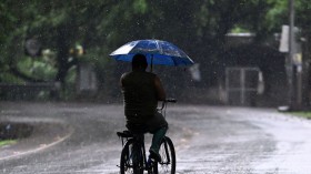
(Photo : Zoom Earth Satellite via NOAA NESDIS). Forecasts show that snowy conditions can spread over Wyoming, Colorado and Utah this week, cauisng slower commutes and travel dangers.
According to NWS advisories, a hazardous weather outlook is likely to impact western Colorado and eastern Utah. Light snow conditions can hit this week with winter weather advisories present in the Colorado mountains with six to 12 inches of snow.
The forecast shows that unsettled weather can unload through the end of the week, with a possible low pressure impacting the Four Corners region. Areas near the San Juan mountains can anticipate snowy conditions.
Meanwhile, Central and Southeast Colorado can check for isolated and brief showers. From Wednesday to early next week, moderate to heavy snow can unload. The heavy snow outlook can unload in Sangre De Cristo Mountains, Northern El Paso County, and Pikes Peak.
On Friday, rain with snow can unload. In the mountainous areas, isolated rain showers are possible. Meanwhile, northeast and north-central Colorado should watch out for a significant winter storm on late Wednesday or Friday, bringing snowfall to portions of the Front Range Mountains. The advisory warns of dangerous commutes.
On the weekend, the weather is expected to change, bringing drier and warmer temperatures. Daily commutes are forecast to become better, but motorists should still be alert for slippery roads.
On the other hand, the forecast warns of a challenging weather outlook in Southwest Wyoming on Wednesday or Thursday. Residents should stay alert for Winter Weather Advisories before leaving. Foggy conditions and snow are likely as a cold front moves into northern Wyoming.
Significant and Long Duration Snow from March to March 16
NWS Weather Prediction Center warns of a significant and long-duration winter storm based on a key message for the March 13 to March 16 winter storm. The forecast reveals that a winter storm can develop and impact portions of Central and Southern Rockies, including the Four Corners region.
Related Article: Denver Weather Forecast: Snowstorm To Bring Travel Concerns, Power Outages This Week
For more similar stories, don't forget to follow Nature World News.
© 2024 NatureWorldNews.com All rights reserved. Do not reproduce without permission.


![Roundworms with Short Memories 'Stop Forgetting' When Frozen or Given Lithium [Study]](https://1471793142.rsc.cdn77.org/data/thumbs/full/70295/280/157/50/40/roundworms-with-short-memories-stop-forgetting-when-frozen-or-given-lithium-study.jpg)
