Weather experts said that heavy rains and mountain snow would increase the risk of floods in the West Coast.
They said that the weather system would tap into moisture from atmospheric rivers, which will heighten the flood risk for millions of residents in the west coast.
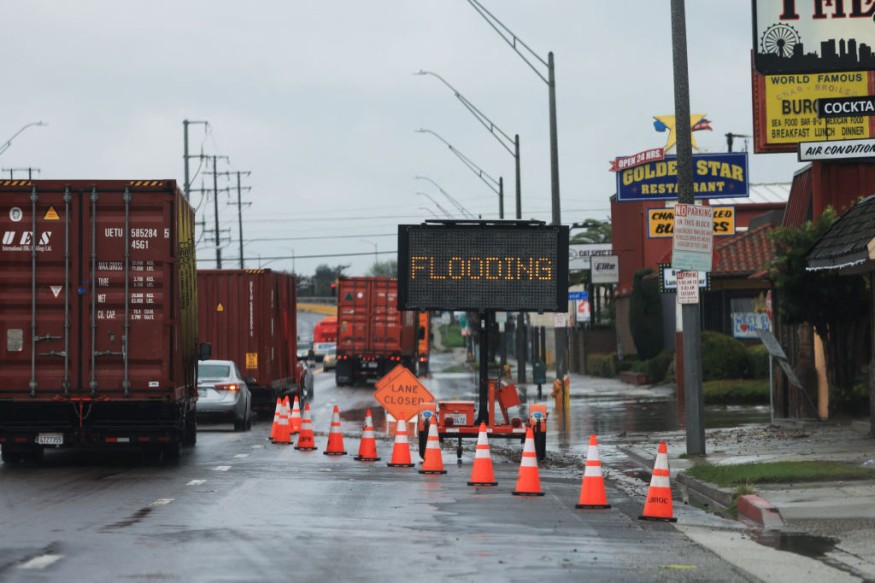
Floods, Mudslides From Large Waves of Storm
Meteorologists said that the proximity of the second storm to the first, hitting roughly the same areas, could bring and escalate floods, mudslides and power issues.
Furthermore, rounds of large waves from both storms will adversely affect the California coast into next week.
Moreover, there will be a possibility for over wash, coastal erosion and property damage in the region.
The National Weather Service said that powerful low pressure system would spread winter, severe and rain hazards across the western and central parts of the country.
In the evening, heavy rains and snow impacts will come to an end over California, while tropical and subtropical moisture converge to spread snow over the Great Basin Intermountain West and Rockies.
Furthermore, from Los Angeles to San Diego, motorists and airlines may also encounter delays and difficulties in the evening.
The worst of the rains and flash flood potential will pivot through Palm Springs, California, Las Vegas and Yuma, Arizona, into the night as well.
Read Also : Florida Stormy Conditions in February: Heavy Rain, Thunderstorms To Impact Outdoor Plans This Week
Snow To Affect Travels
Meanwhile, the snow will continue while the low pressure system tracks across the Four Corners region on Friday.
Snow levels will be lower from north to south across the southern Cascades and Sierra Nevada.
Due to this condition, motorists will encounter difficult travel over Donner Pass, California, as snow continues through Thursday night before tapering to snow showers on Friday.
The weather system will reorganize over the Central and Southern High Plains on Friday while it begins to tap moisture and instability from the Gulf of Mexico.
The said moisture would interact with a prominent jet streak aloft and strong convergence at the surface along a cold front and dryline.
This combination may produce severe thunderstorms across Oklahoma and Texas and the Lower Mississippi Valley beginning in the late afternoon on Friday.
A slight risk (level 2/5) of Severe Thunderstorms is in effect for portions of South-Central Texas where large hail, tornadoes and strong wind gusts will be possible.
The focus for heavy rainfall and thunderstorms will shift into the Lower Mississippi Valley and central Gulf Coast on Saturday where the deep redeveloped low pressure system will move into.
As a result, a Slight Risk (level 2/4) of Excessive Rainfall is in effect for portions eastern Texas, southern Arkansas, Louisiana and southern Mississippi on Saturday.
An omega block ridge over the Central portion of the United States will support mild temperatures from the Great Plains to the East Coast through this weekend.
In addition, some portions of the Northern/Central Plains into the Upper/Middle Mississippi Valley will experience low temperatures from the upper 20s to low 50s through early next week, which may tie or break existing records.
On the other hand, the temperatures in the Southern Plains will be moderate a bit beneath the deepening upper-level low on Saturday.
© 2025 NatureWorldNews.com All rights reserved. Do not reproduce without permission.


