Weather experts said that storms and mountain snow are expected to hit the West Coast in the next ten days.
Based on the forecast, mountain snow and a continuation of coastal threats, which were observed last week, will arrive along the Pacific Northwest coast south to Northern California on Tuesday.
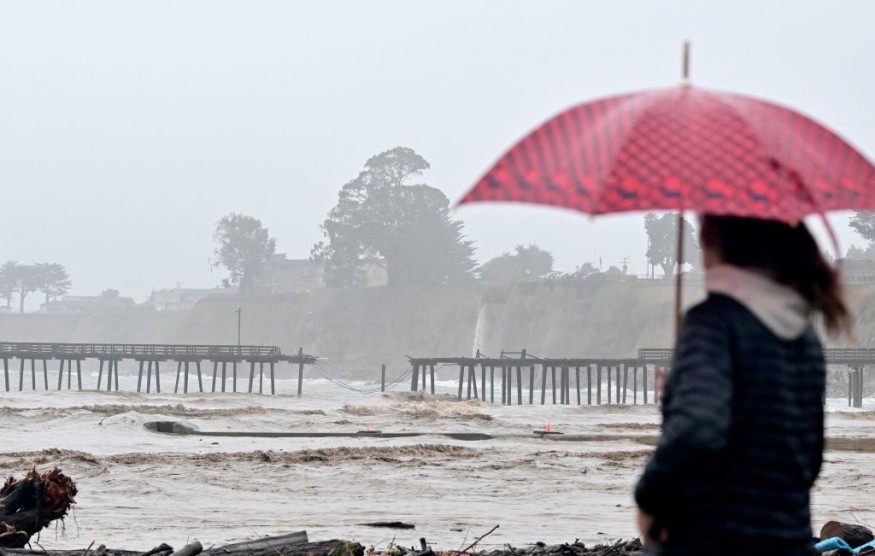
Rain, Snow To Spread
Due to these weather developments, rain and snow will spread south through the Golden State from Tuesday night towards Wednesday.
Moreover, additional storms will then follow into this weekend and the middle of the next week.
Meteorologists do not necessarily consider this as bad news despite the concerns of tourists and travelers with the storms. They believed that this is a very good news for ski resorts across the Sierra Nevada range.
They also said that the next storm would already be gathering steam and moisture offshore in the Pacific Ocean as it will also set its sights on the West by late week.
Officials noted that there would be a short period of dry conditions along the West coast and into the Southwest in the wake of the said storm. They said that another storm would aim at the region into the upcoming weekend.
According to the weather forecast, the next storm may actually come in two fast-moving waves.
They said the first one looks to spare much of the Central and Southern California while delivering locally heavy rain and snow towards the Northern California and the Northwest, including the Cascades and northern Sierra from late Thursday night through Friday.
Weather experts said that this storm would bring the heaviest rain of the week to places such as Portland and Seattle. Moreover, potentially damaging winds will also transpire along the Oregon and Washington coastlines.
Meanwhile, the second wave looks to aim farther south bringing a return of rain to Central and Southern California as well as into the Great Basin region as the first weekend of 2024 gets underway.
In San Francisco, California, the National Weather Service said that drier conditions had returned during New Year's Day. Further, unsettled weather will return by late Tuesday and continue towards Wednesday.
Weather experts also said that gusty southerly winds would develop with the low pressure system on Tuesday.
Effects Of Chilly Air
On the other hand, the chillier air that is expected to accompany the storm could lower snow levels across much of the West.
The chilly air could also bring some impact on the walk on the red carpet before the 2024 Golden Globe Awards ceremony in Beverly Hills on Sunday evening.
Moreover, the storm will then move through sometime during the early and middle part of next week, which will cap what will be a wet and snowy start to this new year.
Following this weather development, meteorologists are expecting a change in the system.
They explained that an area of high pressure pushing into the eastern Pacific near the West Coast around the middle of next week could bring a change where most of the storms will cut inland across the interior West.
They see this to happen rather than impacting areas near the coast.
Weather experts said this would result in less precipitation near the coast as well as in the big cities, and perhaps more importantly, an ease up on the wave action.
Related Article : US Weather Forecast: Strong Winds, Winter Storm Warnings Present in Colorado, Wyoming
© 2026 NatureWorldNews.com All rights reserved. Do not reproduce without permission.


