Multiple states in Australia are on high alert for bushfires due to scorching conditions.
Officials said that the dangerous weather conditions have prompted extreme to catastrophic danger alerts to be issued for parts of southern Australia.
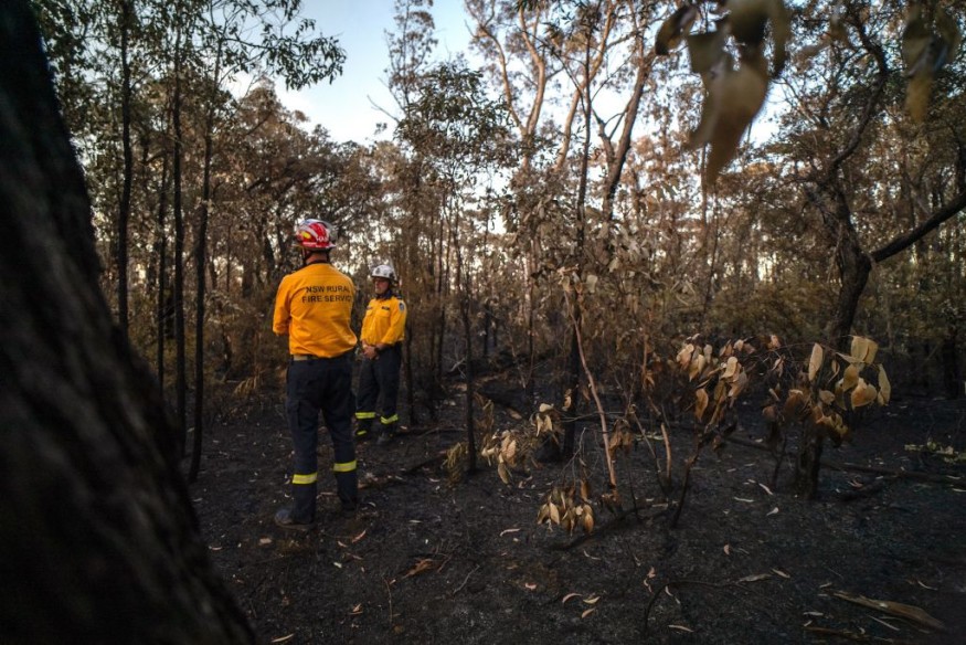
Series Of Fires
The country's fire service already issued a warning that Friday would be one of the most significant fire weather days in a span of several years.
They noted that the temperatures are forecasted to surge into the mid-40s in some parts of the country, with strong winds and dry lightning that may add to the fire risk.
The Country Fire Service already declared catastrophic fire danger ratings for the mid-north, Flinders, Yorke Peninsula, Riverland and eastern Eyre Peninsula districts.
Furthermore, extreme fire danger ratings have been issued for the Mount Lofty Ranges, north-east Pastoral, west coast, upper south-east as well as in Murraylands regions.
Officials said that the dry lightning has already created a real risk of fire starting anywhere whenever these thunderstorms occur.
At present, the CFS has been monitoring a series of fires along the Stuart Highway and Tarcoola Road, between Pimba and Glendambo and stretching out to Kingoonya in Outback South Australia.
On the other hand, a warning message has been issued for the Wirraminna Fire. The public must refer to the CFS website cfs.sa.gov.au for the most up to date warning information regarding the blaze.
Meanwhile, farming and cattle grazing land at the following stations may be affected by the fires: Kingoonya Station, Monlena Station, Glendambo Station, and Wirraminna Station.
Authorities said that the blaze could be visible from the road, noting that they may be causing smoke to result in adverse impacts along the road.
Moreover, officials from the CFS as well as in the Department of Environment and Water (DEW) have monitored a blaze in the Gammon Ranges National Park, north-east of Nepabunna, Iga Warta and east of Leigh Creek in the Northern Flinders Ranges.
A warning message had been issued for the Gammon Ranges NP fire. Meanwhile, the fire has already burnt approximately 12,000 hectares of national park in largely inaccessible terrain.
The Gammon Ranges Fire had burned in a south-westerly direction, according to authorities.
Additionally, CFS trucks and resources have been deployed and travelled up to Leigh Creek to provide support if required for response measures.
Bushfire Survival Plan
Members of the affected areas and communities have been urged to take care, particularly if they are planning to drive to or through the area.
Authorities also urged residents to have a bushfire survival plan in place in order to understand what they would do during the event of an emergency.
Meanwhile, they also warned that electricity outages are possible as equipment is set to disconnect in order to minimize the risk of sparking a blaze.
Officials advise residents to check and follow the bushfire survival plan.
They should also decide on what to do if the fire situation changes.
The public should also look and listen for information on television, radio, internet, mobile phones and by speaking with neighbors.
Related Article : Bushfire Risks Likely in Australia Due to Dry, Warmer Temperatures
© 2026 NatureWorldNews.com All rights reserved. Do not reproduce without permission.


