Weather experts said that storms are expected to soak the northwest and spread snow over Cascades and Rocky Mountains by December.
This weather phenomenon is expected following a weak storm that dampened western California.

High Pressure in the Northern Hemisphere
Meteorologists said that residents across Oregon, Northern and Central California and Nevada into the Rocky Mountains would continue to experience mostly sunny skies and dry conditions through Tuesday afternoon due to the high pressure that dominates the region.
They said that in an anticyclone or high pressure, the winds tend to be light as it blows in a clockwise direction in the northern hemisphere.
Meanwhile, the air is also descending, which later reduces the formation of cloud and leads to light winds and settled weather conditions.
Based on weather forecast, a new storm will begin to push into the California coast with rounds of showers by Tuesday evening.
Furthermore, locations such as San Francisco, Los Angeles and San Diego will encounter chances of showers as this feature tracks into the Southwest and are expected to bring slightly cooler conditions in the said areas.
On the other hand, temperatures are likely to fall between 5 and 10 degrees Fahrenheit from early in the week to late in the week along the California coast.
Weather experts said that areas such as Santa Monica, California are expected to range in the mid-60s F through Tuesday then it is forecasted to dip to the upper 50s F from middle to late parts of the week.
When it comes to San Diego, residents there are on track to have afternoon highs near 70 through Tuesday.
However, the temperatures will reach only the lower to middle 60s by late in the week.
Authorities said that many areas will tip the scales this week from starting out slightly above typical late-November conditions to temperatures that will fall just below the historical averages.
Meanwhile, the midweek storm will be far from a drenching atmospheric river, but this will still prompt California residents to reach for their umbrellas.
Rain will taper off in most of California by Wednesday night as the system loses some steam as it tracks inland.
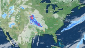
On the other hand, rains will also continue its journey eastward over the Four Corners and eventually the South Central states.
This weather condition will draw in moisture from the Gulf of Mexico that will deliver rain and thunderstorms to more than a dozen states.
Snowfall in the Northwest
When it comes to snowfall, meteorologists said this can begin to accumulate across the higher terrain in the Northwest.
Through the weekend and even into early next week, chances will remain high for snow to spread into the northern and central Rocky Mountains.
They said that snow levels can drop as low as 2,500 feet by Thursday night as the first storm moves through.
Moreover, snow levels are predicted to rise by Sunday, but snow could still potentially impact travel through major passes like Snoqualmie Pass.
The heaviest snow totals are seen to occur across the Cascade range, which can quickly disrupt travel across the higher terrain heading into the weekend.
Related Article: Coastal Storm To Bring Delays In Air Travel And Reduced Roadway Visibility Across The Northeast
© 2024 NatureWorldNews.com All rights reserved. Do not reproduce without permission.


![Roundworms with Short Memories 'Stop Forgetting' When Frozen or Given Lithium [Study]](https://1471793142.rsc.cdn77.org/data/thumbs/full/70295/280/157/50/40/roundworms-with-short-memories-stop-forgetting-when-frozen-or-given-lithium-study.jpg)