Following a multi vortex tornado that struck Kansas during a multiday severe weather event, no damages were reported. Experts are urging locals to stay updated with the latest weather news.
Multivortex Tornado During a Multiday Severe Weather
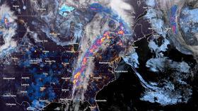
On Thursday evening, severe weather erupted across parts of the Plains, and a storm chaser captured footage of a major tornado near Norton, Kansas, in the northwest of the state. During multiday severe weather, dozens of storm reports were received from Kansas to Texas. The dangerous thunderstorms were part of a multiday severe weather phenomenon that was developing across the central United States, according to AccuWeather meteorologists.
Dan Fitts of Severe Studios recorded a video of the tornado, which revealed several vortices churning inside the tornado to the northwest of Norton. Large multivortex tornadoes with many zones of spin embedded in the main funnel are the norm. These embedded vortices frequently cause more serious harm.
Several different multiple vortex spinups 10-12 miles SE of Lebanon, Nebraska but in Kansas under an impressive rotating wall cloud 7:45PM @NWSGoodland @SevereStudios #newx #kswx pic.twitter.com/EqUxWiaz3P
— Dan Fitts (@Dan_Fitts) September 22, 2023
Fortunately, No Damages Reported
The sheriff's office stated that Norton, however, had not received any reports of damage.
Tornado warned supercell timelapse from Harvey, Iowa earlier this year!
— Live Storm Chasers (@LiveStormChaser) September 22, 2023
LSC/Murphy Roberts | May 13, 2023 pic.twitter.com/qSeaMsnrg5
As far south as northern Texas, the intense thunderstorms also produced torrential rain, damaging gusts, and huge hail. Southern Nebraska and northern Kansas were hit by hailstones the size of tennis balls and baseballs. Baseball-sized hail destroyed cars and pulled leaves off trees in the little city of Red Cloud, Nebraska, which is situated in the extreme south-central region of the state.
A storm chaser for AccuWeather, set out to photograph severe weather. Around 35 miles southeast of North Platte, Nebraska, Maywood is where AccuWeather paused to get images of mammatus clouds on Thursday night. These bulbous clouds frequently form behind the anvil clouds connected to powerful thunderstorms.
Parts of the Plains are forecast to experience severe weather every day through the weekend. On both Friday and Saturday, AccuWeather meteorologists indicated "moderate" risk zones for severe storms.
Also Read: Heatwave Leaves But Wildfires Remain as El Niño Starts with Gusty Winds in Australia
More On Multivortex Tornadoes
A multi vortex tornado, or multiple vortex tornado as NOAA refers to it, is a tornado with tiny, fast-spinning whirls known as subvortices or suction vortices. These vortices are sometimes more difficult to see than in large tornadoes. In a tornado's circulation, suction vortices can increase the ground-relative wind speed by more than 100 mph.
They are therefore to blame for the majority, if not all, instances in which tornado trajectories contain small arcs of tremendous destruction that are immediately adjacent to weak damage. Subvortices typically last under a minute and occur in clusters of 2 to 5 at once; the 6 or 7 shown here are unusual.
The majority of stories of multiple tornadoes occurring simultaneously, from news reports and early 20th-century tornado tales, are now thought to be multi vortex tornadoes, according to tornado scientists. However, satellite tornadoes-separate tornadoes that originate near one another-rarely occur.
Safety During Tornadoes
Tornadoes could be deadly and most injuries and deaths occur from flying debris. While no place is entirely safe, some are safer. Experts say to stay in basements or windowless rooms on the lowest floor of a building. Staying outdoors, in mobile homes, or cars is not recommended. The best option is to find a way to stay indoors and to stay updated.
Related Article: 'Homebrew' Tropical Storm Grows Stronger on Path to US East Coast, Experts Warn Potential Tropical Cyclone 16
© 2024 NatureWorldNews.com All rights reserved. Do not reproduce without permission.


