The latest weather report showed that about 200,000 still had no power in the Midwest after a powerful derecho emerged in the region, causing significant damage to fields, properties, trees and powerlines.
Before July finally began, many Americans dealt with the severe weather in the Southeast, Northeast and Midwest. Damaging winds and heavy downpours are unloading, causing slower commutes and travel disruptions.
In the Southeast, Nature World News' previous report showed that the challenging heat would unfold after hitting portions of Texas with a troublesome heat dome.
This week, possible severe weather risks could unfold on the 4th of July, bringing flooding downpours, hail and damaging winds.
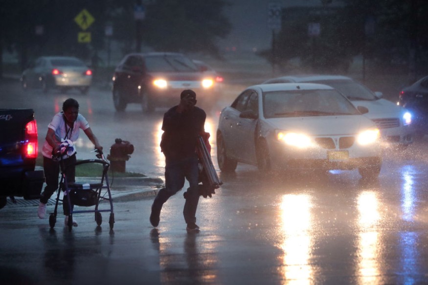
Midwest derecho
In the latest weather forecast, AccuWeather reported that a derecho with strong winds hit the Central United States and Midwest, leaving many Americans without power.
Based on the power outage.us report, about 220,000 people had no power on Sunday, making it more difficult for the affected residents.
The reports also showed that trees and powerlines were turned down, as many corn fields suffered from the heavy impact of the extreme weather.
Meanwhile, the damaging winds eased the unhealthy levels of poor air quality in the Midwest. However, the report still warned of the possible impact of the reduced air quality.
The derecho event could lead to a dangerous situation.
According to Red Cross, staying safe during derecho events is essential, adding that it could unleash strong winds and heavy downpours.
Americans should keep alert for weather warnings, especially for isolated tornadoes and derecho risks. Preparing emergency plans would help you stay safe and prepared.
Weather forecasts in portions of the United States
The National Weather Service (NWS) reported that severe thunderstorms are forecast in portions of the Northern Great Plains and Mid-Atlantic region. Excessive heat conditions are forecast in the Southwest on the 4th of July.
The forecast noted severe thunderstorm watch is present in portions of the country, bringing possible damaging winds, large hail and tornadoes.
Locally heavy rainfall and large hail could become possible this week due to the severe weather outlook.
Meanwhile, the forecast noted that excessive heat warnings or dangerous heat could be possible in the Southeast.
Furthermore, the weather forecast showed that severe thunderstorms could become likely this week, causing flooding downpours, hail and damaging winds.
The forecast noted that severe thunderstorms could be likely in Jackson, Atlanta, Asheville, Charleston and Virginia Beach.
The weather report explained that possible thunderstorm conditions could unfold in Billings, Minneapolis, Chicago, Dallas, Memphis, Charlotte, Washington, Boston, New York and Jacksonville.
Did you know?
As July begins and the summer season is the air, hotter conditions could become most likely. According to Fox News, the hottest and most challenging temperatures would be in the month of July.
Related Article : US July Weather Forecast: Severe Storm Likely to Hit Vermont and New Hampshire, Carolinas, Mississippi
For more similar stories, don't forget to follow Nature World News.
© 2026 NatureWorldNews.com All rights reserved. Do not reproduce without permission.


