After a "strong zonal jet" powers its way straight across the Atlantic, a "vigorous low pressure" front will slam into the UK, soaking the country with heavy rain and strong winds.
Britain will be hit by persistent rain, and the Met Office has issued a new weather warning for 70mph winds, putting millions on high alert.
WXCHARTS' most recent UK weather maps show a massive band of heavy rain sweeping in across the Atlantic and hitting England's South West coast on Thursday evening.
This is expected to quickly move across large parts of Britain over the next few hours and into Friday, soaking the bottom half of the UK map.
'Vigorous' front to soak nation in hours
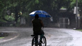
 (Photo : BEN STANSALL/AFP via Getty Images)

On Friday, the rain will continue to fall over this half of the country before clearing later in the day and over the weekend.
According to the forecast, more than 30mm of rain will have fallen in southern England from today until the weekend.
Netweather Senior Forecaster Jo Farrow warned that on Thursday night, a "vigorous low pressure" linked to a "strong zonal jet powering its way straight across the Atlantic" will move across the UK.
This will result in heavy rain and high winds.
Earlier this week, Farrow predicted that a major Atlantic low would send weather fronts across the UK on Tuesday and today.
According to Ms. Farrow's latest weather forecast, a strong low-pressure system is expected to move across southern Britain on Thursday night, bringing strong winds and a period of heavy rain.
It is linked to a powerful zonal jet that is tearing across the Atlantic.
Also Read: UK Weather Forecast: Thunderstorms Expected Across UK as Flood Warnings Remain in Effect
Mild But Windy
Many areas will be dry this evening, but there will be a few showers in the north and west, as well as more widespread rain in southern Britain and the far northeast, as per Sky News.
Showers will be widespread tomorrow morning, with some being heavy and thunderous, but most places will also see long periods of sunshine.
The majority of the country will see little change through the afternoon, with showers becoming more isolated towards the evening, but the southwest will become wet later.
For the most part, Friday will be another windy day, with gales near the Channel coasts, prolonged rain in the south and west, and a few showers elsewhere.
The central areas are also grey, with misty low clouds spreading in from the North Sea.
Tyler Roys, AccuWeather Senior Meteorologist, and Lead European Forecaster told Express.co.uk that three rounds of rain are expected to hit the UK this week: yesterday, today, and the final one on Thursday afternoon and continuing into Saturday.
He did, however, warn of flooding and winds of up to 70 mph.
Localized flooding is possible in poor drainage areas of Southwest England Thursday night and Friday, primarily in the typical areas seen by residents.
A windstorm is expected to sweep into southern England Thursday night and Friday.
The strong winds from this storm are expected to blow across southwest England and the English Channel coast.
Wind gusts of up to 70mph are possible in southwest England and the English Channel Islands, with gusts of up to 60mph expected elsewhere.
The storm is expected to lose intensity at this point, so strong winds are not expected to be widespread."
Related article: UK Weather Forecast: High Winds, Heavy Rain Expected to Unfold This Week
© 2024 NatureWorldNews.com All rights reserved. Do not reproduce without permission.
![Tsunami Hazard Zones: New US Map Shows Places at Risk of Flooding and Tsunamis Amid Rising Sea Levels [NOAA]](https://1471793142.rsc.cdn77.org/data/thumbs/full/70325/280/157/50/40/tsunami-hazard-zones-new-us-map-shows-places-at-risk-of-flooding-and-tsunamis-amid-rising-sea-levels-noaa.jpg)


