Northern Europe is expected to return to winter this week, with temperatures falling significantly below seasonal norms due to a very cold Arctic air mass.
Meanwhile, more tropical conditions will develop in the continent's southernmost regions.
The UK is likely to be on the northern edge of these air masses, which, combined with low-pressure systems moving in from the west, could cause significant outbreaks of sleet and snow in some areas by midweek.
Under these conditions, snow will fall in parts of Scandinavia as well.
These wintry conditions will feel especially harsh in comparison to the recent mild temperatures.
This cold spell, however, should be brief, with a return to spring-like temperatures expected by early next week.
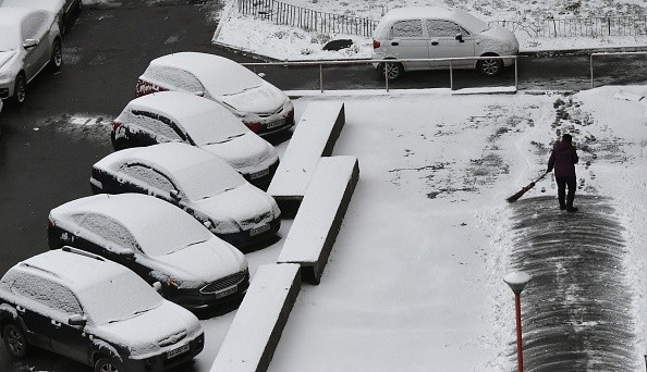
Northern Europe Facing Cold Snap
 (Photo : SERGEI SUPINSKY/AFP via Getty Images)

Other parts of the world were not so fortunate last month, with parts of the United States ending the month on a very turbulent note, as per The Guardian.
On February 26, a band of severe thunderstorms swept across parts of Texas, Oklahoma, and Kansas.
These storms brought torrential rain, large hail, wind gusts exceeding 70 miles per hour, and 17 tornadoes, resulting in one death and dozens of injuries.
Later that day, a powerful tornado struck Norman, Oklahoma, passing dangerously close to government buildings, including the National Weather Centre.
Peak winds of 130-135mph (209-217km/h) caused power outages, gas leaks, and significant building damage.
On February 27, the severe weather moved northeast, bringing similar conditions to parts of Illinois, Indiana, and Ohio.
Vanuatu, a Pacific island nation, has been hit by two cyclones and two earthquakes in the last week.
Cyclone Judy was the first to make landfall on March 1.
This category 4 cyclone had a maximum wind speed of 121mph (195km/h), causing significant damage to infrastructure and crops, as well as severe power outages affecting over 160,000 people.
Only a few days later, on March 3, Vanuatu was hit by a second category 4 cyclone.
Not only did Cyclone Kevin cause more damage due to previously weakened infrastructure, but it also reached a top wind speed of 162mph (260km/h).
Despite the fact that both cyclones passed over Vanuatu, Judy originated over Wallis and Futuna, located to the northeast, and Kevin originated off the coast of Australia, located to the northwest.
Snow and ice warnings extended
Yellow weather warnings for parts of north-east Scotland and England remain in effect until Wednesday morning, as per the BBC.
On Monday, the Met Office issued a slew of additional yellow warnings for much of the UK for the next five days.
Heavy snow could cause "significant disruption" in northern and central areas on Thursday and Friday, according to the forecast.
Forecasters are predicting a "major change" as Arctic air sweeps in from the north, bringing snow, ice, and freezing temperatures to many.
A new ice and snow warning is in effect for parts of the Midlands, East, South of England, and Wales between 21:00 GMT tonight and 10:00 on Tuesday.
According to the Met Office, this could cause "difficult travel conditions" in some areas.
Some roads and railways in these areas were likely to be affected, and people should expect longer travel times.
Overnight, a similar warning covering much of Northern Ireland was also issued.
Another warning states that snow will cause some travel disruption in parts of southern England and Wales on Wednesday.
Heavy snow warnings are in effect for much of Scotland, northern England, parts of the Midlands, north Wales, and Northern Ireland for Thursday and Friday.
Weather conditions may disrupt travel and other daily activities, and more alerts are likely.
The first Met Office warning was issued for parts of Scotland on Sunday evening, including Aberdeen and Dundee, the Highlands, Orkney, and Shetland.
On Monday, the warning was expanded to include more of Scotland as well as a corridor of north-east England extending to Newcastle upon Tyne and Yorkshire.
Tuesday's coverage expands to include Strathclyde, more of Yorkshire and the Humber, and the East Midlands.
Snow is expected to fall frequently, with northern Scotland experiencing frequent and often heavy snow showers on Monday afternoon.
Snow could cause delays on these roads, as well as rail and plane cancellations, according to the Met Office.
It also warned about the dangers of slipping and falling on icy surfaces.
It said there was a "slight chance" that rural communities would be cut off, and that power and phone services would be affected.
Related article: UK Weather Forecast: Sudden Stratospheric Warming to Bring Snow and Blizzards in Coming Weeks
© 2024 NatureWorldNews.com All rights reserved. Do not reproduce without permission.


![Climate Change is Reducing Dust Levels Worldwide as Arctic Temperature Warms [Study]](https://1471793142.rsc.cdn77.org/data/thumbs/full/70320/280/157/50/40/climate-change-is-reducing-dust-levels-worldwide-as-arctic-temperature-warms-study.jpg)

