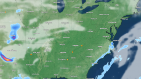
On Tuesday, a band of heavy rain moved north and east across the UK, with the heaviest rain clearing across southwestern areas but spreading into northern areas, with a focus across eastern Scotland.
According to Met Office Chief Meteorologist Frank Saunders, a series of weather fronts and low-pressure systems will cause wet and windy weather to dominate the UK this week.
Some of these rain bands will be heavy, causing delays in travel and possibly flooding in some areas. There are several National Severe Weather Warnings in effect.
Low pressure to come
 (Photo : Leon Neal/Getty Images)
A new low-pressure system and the next more persistent spell of rain arrive from the west on Wednesday evening, following an unsettled start to the day but with some sunshine.
"While there are still some uncertainties around the timing of this system, there's a good degree of confidence it will track northeast through Thursday, clearing the far northeast early on Friday," Met Office Deputy Chief Meteorologist Steven Keates said.
Strong winds are also expected for the majority of the country, with coastal gales possible. On Thursday, the strongest winds are expected in the far northeast of Scotland and the Northern Isles, with gusts exceeding 60 mph possible.
Saturday may provide a brief reprieve from the winds and rain before another front moves in from the west, bringing more rain and wind. Even in the south, it will feel cold, with a chance of patchy frost overnight.
Uncertainty and changeability are expected to persist for much of next week, with bands of rain and strong winds, particularly in the west.
However, clearer showery conditions are possible at times. Temperatures are expected to be average for the season, if not cold for this time of year in the north.
Read more: Heatwave to Hit the UK in April and Climate Change is to Blame: Met Office Forecast
Flood warning as heavy rain to batter parts of Britain
The Met Office has issued a yellow weather warning for heavy rain, with flooding possible across much of the United Kingdom, as per Independent.
The forecaster has issued a warning for most of the UK until 9 p.m. on Tuesday, with bus and rail services potentially disrupted.
The alert has been issued for London and the south east of England, as well as Wales, the south west of England, and parts of Scotland.
Some of the rain will be heavy, with 15-30 mm falling widely and up to 40-50 mm falling over parts of Dartmoor and south-facing high ground in southern Wales, the Marches, and parts of southern England," the forecaster added.
Rain will affect much of the UK during the early part of this week, according to Met Office chief meteorologist Steven Ramsdale, with a weather front on Tuesday bringing heavy rain and strong winds at times.
Rain on Tuesday is expected to disrupt travel and cause flooding in some areas.
Parts of southern Wales, southern England, and eastern Scotland are expected to receive the heaviest and most persistent rain, with some areas receiving more than 30mm of rain and some exposed parts of eastern Scotland potentially receiving 50mm.
Many will have a wet day, with 10-20mm of rain falling across much of England, Wales, and Scotland.
Showers are also expected as part of an unsettled day on Wednesday.
The Met Office predicts that rain will be most prevalent on the southern and western coasts before low pressure and a more persistent spell of rain arrive from the west on Wednesday evening.
Temperatures will fall back to average for the time of year this week, according to the Met Office, though with the strong winds and rain, it will feel much cooler than the unseasonably mild conditions seen in recent days.
Related article: UK Weather Forecast Indicates Nationwide Scorching Temperatures from Mid-Week
© 2024 NatureWorldNews.com All rights reserved. Do not reproduce without permission.