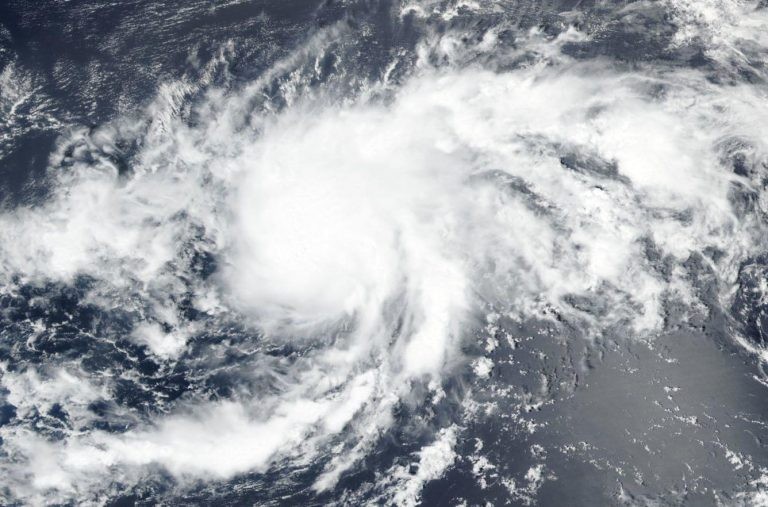
On Tuesday, a new tropical depression developed over the Atlantic Ocean. The National Hurricane Center (NHC) reported that Tropical Depression 12 developed late Tuesday afternoon far out over the Atlantic Ocean, close to the west of the Cabo Verde Islands.

Developing Weather Condition
According to AccuWeather meteorologists, one of two new significant candidates for tropical development in the Atlantic basin this week, the newly formed tropical depression is worth keeping an eye on for potential adverse conditions. Although neither developing storm poses an immediate threat to the United States, at least one will drift westward across the Caribbean Sea.
The following named storm in the Atlantic hurricane season, Tropical Depression 12, is possible, although it is not anticipated to pose a danger to land.
A tropical wave headed into the Windward Islands on Tuesday is the system that AccuWeather meteorologists have been watching grow since early last week when Ian was forming over the Caribbean. Over the weekend, the NHC designated the tropical wave as Invest 91L to intensify its investigation.
Also Read: Northeast Beaches May Experience Drizzles As Leftover Energy from Ian Looms Over
From the Atlantic
The tropical wave began traveling west a few hundred miles east of the southern Windward Islands. On Monday, satellite imaging of the disturbance's clouds revealed some faint spin. Tuesday saw a significant uptick in thunderstorm activity around the system's core. Both might be the first indications of organization, according to forecasters.
This system's potential for growth will fluctuate during the weekend. The system has until midweek to organize and solidify, according to AccuWeather Chief On-Air Meteorologist Bernie Rayno. "Disruptive wind shear will continue to be low until Wednesday."
The occurrence of strong winds that blow in just one direction is known as wind shear. When it's significant, wind shear can stop tropical systems from developing or make them weaker.
Wind shear will heighten as the storm passes over the eastern and central Caribbean during the middle and later portion of the week.
As the week went on, Rayno added, "a storm in the high atmosphere near the Leeward Islands looks to be extending southwestward, causing wind shear to grow near the system, which might prevent it from forming at all or prevent it from intensifying much."
Over the following days, 91L is projected to make very limited progress, which will not be conducive to a hurricane's quick development.
Potential Trajectory
The system's closeness to South America may hinder its growth throughout this week's middle and end. However, as it travels westward, the southern Caribbean's islands and shoreline will experience an increase in soaking rains, violent thunderstorms, and rough waves from west to east.
Contrary to steering winds that permitted Fiona and Ian to reverse course, a passage to the north seems to be barred by high pressure until this weekend. As a result, it poses less of a threat to the United States or the northern Caribbean. Strong tropical systems can occasionally circumvent obstacles in their way by changing the atmosphere around them. Tropical systems that are more intense than those weaker might turn farther to the right or track farther to the north due to physics.
Related Article: Exposure to Major Disasters Can Cause Long-Term Mental Health Problems
For more climate and weather updates, don't forget to follow Nature World News!
© 2024 NatureWorldNews.com All rights reserved. Do not reproduce without permission.


![Roundworms with Short Memories 'Stop Forgetting' When Frozen or Given Lithium [Study]](https://1471793142.rsc.cdn77.org/data/thumbs/full/70295/280/157/50/40/roundworms-with-short-memories-stop-forgetting-when-frozen-or-given-lithium-study.jpg)


