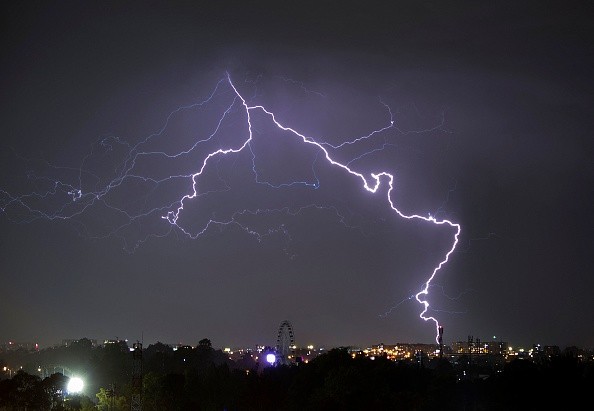
This week, parts of southeast Australia are experiencing La Nina-style rains, gusts, and thunderstorms, with severe weather and significant flood warnings in effect across the country.
Due to a succession of cold fronts, the worst of it is likely to hit NSW and South Australia on Tuesday, with Victoria and Queensland also affected.
Showers, wild winds, and thunderstorms forecast
 (Photo : GUILLERMO MUNOZ/AFP via Getty Images)

The Bureau of Meteorology has cautioned people in those regions that the rest of the week might be chilly, rainy, and windy, as per News.com.au.
For the rest of the week, a succession of cold fronts will bring cool, rainy, and windy conditions to southeast Australia.
Thunderstorms for inland areas may bring severe rains, according to the forecast.
Flood warnings are in effect throughout New South Wales, with the possibility of catastrophic flooding at various river catchments on Tuesday.
Major flooding persisted in the lower Lachlan River on Monday, peaking at 6.83m. It is expected to continue above the major flood threshold until Friday.
From Tuesday, the Lachlan River flood peak may create significant flooding at Jemalong.
Since Sunday morning, the Namoi River near Wee Waa (Glencoe) has been inundated. The river level is expected to peak at 6.9m overnight Wednesday and Thursday.
As the floodwaters move downstream along the Narran River, severe flooding is likely in Angledool beginning Tuesday.
While some places are anticipated to be spared by Tuesday, the bureau has warned of continued river level rises and extended floods on Wednesday and Thursday.
According to the forecast, a low-pressure system will deliver widespread moderate rainfall to rural NSW on Wednesday and Thursday.
Rain is predicted to begin in the west and spread throughout the majority of the state on Wednesday and Thursday as the low moves east during the latter portion of the week.
State Emergency Service has issued a safety warning
The interior districts will be most hit, although showers are also expected in Sydney and Brisbane.
The rain on Wednesday will be significant enough to trigger flash and riverine flooding in western NSW, with a flood watch and severe weather warning already in effect, according to the weather service.
Six-hour rain rates of 60 to 70 mm are likely in Central West NSW on Wednesday morning and afternoon, according to certain prediction models.
As the weather system approaches, the NSW State Emergency Service (SES) has issued a safety warning for persons living in inland regions.
The soggy ground is causing worry, according to Adam Jones, a 9news representative.
Understand your risk and be prepared. Make a strategy and act quickly. We all have distinct risk factors that might stymie our progress.
Jones reported 28 rescues in the Lachlan, Central West, and New England districts during the previous several days.
A strong negative Indian Ocean Dipole is fueling the rainy and stormy weather (IOD).
"Most worldwide prediction models suggest that the negative IOD will endure throughout the remainder of the Southern Hemisphere's spring before breaking down at the start of summer," the report added.
It comes just a week after the declaration of a third straight La Nina event for the summer.
Related article: Severe Thunderstorms, Flood will Soak Northeast Region Monday Through Thursday
© 2024 NatureWorldNews.com All rights reserved. Do not reproduce without permission.


![Plastic Pollution: Scientists Include Spores of Plastic-Eating Bacteria ‘Bacillus Subtilis’ to Develop 'Self-Digesting Plastic' [Study]](https://1471793142.rsc.cdn77.org/data/thumbs/full/70396/280/157/50/40/plastic-pollution-scientists-include-spores-of-plastic-eating-bacteria-bacillus-subtilis-to-develop-self-digesting-plastic-study.jpg)


