Flood watches are in place for over 80 million people across the US East Coast as of Tuesday, September 6, as localized heavy rain and flash flooding threatens the region. This is according to the National Weather Service (NWS) which forecasted that a weather disturbance is possible from the Lower Mississippi Valley to the Mid-Atlantic and New England regions.
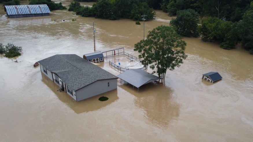
The inclement weather has already affected western Georgia, where media reports call the heavy downpour as a very rare rainfall event as floodwaters swept through homes and businesses on Sunday, September 4. The natural disaster prompted Georgia officials to issue a flash flood emergency, which would allow the hastening or recovery efforts and access to federal emergency funds.
The latest weather developments come after Tropical Storm Danielle intensified into a hurricane over the North Atlantic Ocean last week. The Eastern Seaboard is also still recovering from the series of extreme heat waves and drought conditions that have occurred in recent months. Now, the East US is set for another round of excessive rainfall, with a high chance of flash flooding throughout 20 states.
WPC Forecast
The Weather Prediction Center (WPC) in College Park, Maryland, stated on Tuesday that an unsettled weather and scattered flash flood have chances to linger over the Appalachians, Northeast, and Gulf Coast into midweek.
This means that the adverse weather is possible to strike the Eastern half of the US in the coming several hours until Wednesday, September 7.
The WPC mentions that torrential rainfall rates within slow-moving thunderstorms may lead to widespread incidents of flash flooding from southern New England to the Delmarva Peninsula, affecting major routes as such Interstate 95 (I-95) cities from Boston to Philadelphia.
Furthermore, flash flooding is possible under an upper-level low over West Virginia and the central Appalachians, the US weather agency says.
Eastern US Flash Flood Watch
In fact, the said flood watches are in place from Alabama to Maine and affecting a list of major cities, including Atlanta, Birmingham, Nashville, Cincinnati, Louisville, Pittsburgh, Philadelphia, Boston, and New York, CNN reports.
CNN Meteorologist Rob Shackleford notes that the heaviest downpours are likely in the Northeast, where a scattered amount of 2 to 4 inches are possible. In addition, isolated areas could experience up to 10 inches of rainfall.
Flash Flood Emergency
As US meteorologists continue to forecast the wet weather, some US regions have already felt the impact of the extreme weather, like Georgia as mentioned earlier.
The said rare flooding occurred after rivers and creeks overflowed, prompting local authorities to conduct water rescues, according to The Guardian. The most affected areas of the state include Chattooga and Floyd counties during a two-day thunderstorm and heavy rain over the weekend.
In Indiana, one woman died after a flash flood pummeled through numerous homes and made a runoff on several roads. Jefferson County in the state also saw 9 inches of rain on Saturday, September 3, causing infrastructural damage, according to USA Today.
© 2026 NatureWorldNews.com All rights reserved. Do not reproduce without permission.


