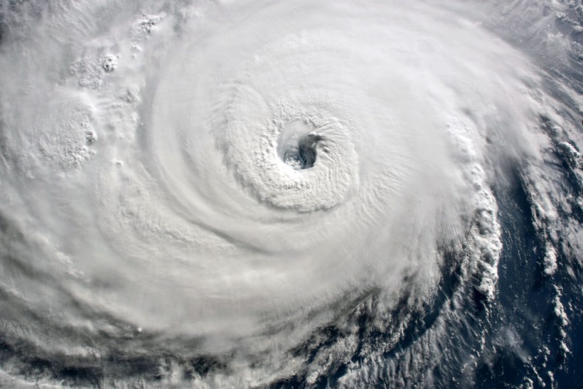
A tropical depression strengthened into system called "Tropical Storm Danielle" which could threaten the United States East Coast and its surrounding regions, according to the National Hurricane Center (NHC). The former tropical depression was being monitored by NHC meteorologists, who forecasted that the storm system was likely to form as a named tropical system over the Labor Day weekend.
Tropical Storm Danielle is hovering over the Atlantic Ocean, which is still far from the Eastern Seaboard coast as of Thursday, September 1. However, US meteorologists have predicted storm Danielle could traverse near the mainland US or Canada in the coming days, bringing strong winds and the risk of coastal flooding. If not, Danielle could reportedly dissipate within the given period.
The brewing Atlantic storm was initially covered by Nature World News on Wednesday, August 31. During that time, both US media and US government forecasters estimate the potent storm system could intensify into a storm until Monday, September 5. Furthermore, there were three tropical disturbances being monitored, which includes of what is now Tropical Storm Danielle.
The latest developments come after a quiet August, when no official named storm system formed over the North Atlantic Ocean even during the current Atlantic hurricane season, which spans from June to November each year. In spite of the absence of a storm or hurricane, the US was rocked by a series of severe weather, torrential rain, flash flooding, and scorching heat waves in recent months.
Tropical Storm Danielle

The NHC on 08:00 a.m. EDT (local time) on Thursday confirmed the intensification of the storm system from depression into a storm as part of a four-tier level used by the US hurricane agency when determining their strengths, which is mainly based on their minimum and maximum wind speed.
Amongst the four levels, a tropical depression is the weakest with a wind speed of less than 39 miles per hour (mph). It is followed by a tropical storm with a wind speed between 39 mph and 73 mph.
Meanwhile, a hurricane has a wind speed between 74 mph and 110 mph. Lastly, a major hurricane is the strongest with a wind speed of greater than 110 mph.
In the case of Danielle, it is still not clear if weaken into a depression again or intensify into a hurricane in the short-term period.
Also Read: Atlantic Hurricane Season to Peak this Month
Atlantic Hurricane Formation
In reiteration, the 'no hurricane' incident in August is the first time in 25 years where US weather authorities have not provided a named storm in the Atlantic, according to the The New York Times.
It is known that hurricanes form as a result of absorbing heat from tropical waters, according to the National Oceanic and Atmospheric Administration (NOAA).
Yet, the Atlantic hurricane season was met by persisting above-average temperatures in the form of heat waves at some point from the onset of the US summer season in June.
Related Article: Labor Day Storm: US Meteorologists Expect a Named Tropical System by September 5
© 2024 NatureWorldNews.com All rights reserved. Do not reproduce without permission.


![Roundworms with Short Memories 'Stop Forgetting' When Frozen or Given Lithium [Study]](https://1471793142.rsc.cdn77.org/data/thumbs/full/70295/280/157/50/40/roundworms-with-short-memories-stop-forgetting-when-frozen-or-given-lithium-study.jpg)

