Heavy rain is likely to persist from northern Texas to southern Oklahoma corridor into the middle of the week, according to the latest weather forecasts.
Based on the weather outlook, there is a risk of extensive flooding, excessive runoff, travel delays, and drought relief.
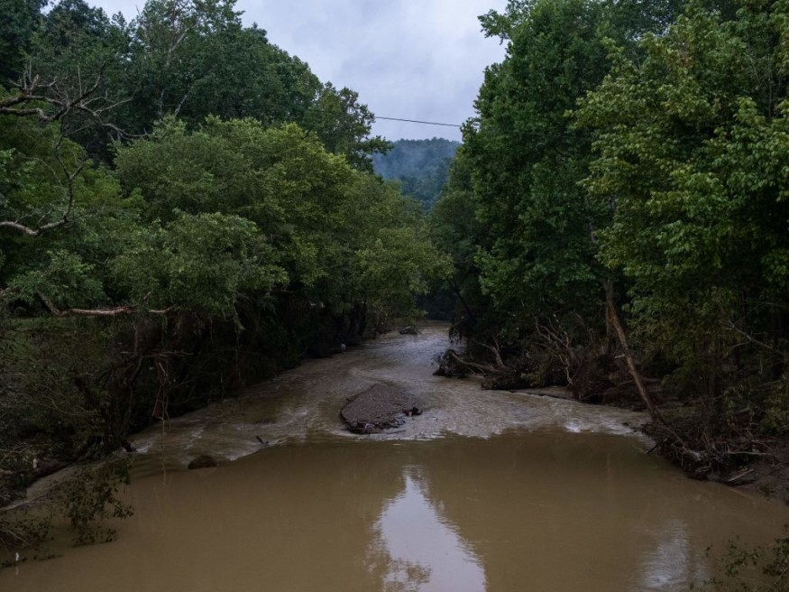
The torrential rain's main threat will be the rapid rise of floodwaters in low-lying areas and communities at the bottom of mountains and hills.
Cities and towns near bodies of water like rivers and lakes are also at risk, since a heavy downpour will lead to an overflow.
Based on previous reports, the inclement weather could damage power lines, causing power outages that can affect both residences and commercial establishments.
The threat comes after similar weather events inundated the southwestern United States and Eastern Kentucky.
Over the weekend, millions of Americans were placed under flood watches across the South US. Triggered by weather disturbances, rainfall is being caused by a slow-moving front over the region Gulf of Mexico.
Several inches of rain had already fallen into the Texas-Oklahoma corridor.
There were no immediate reported casualties, fatalities, or injuries, from the adverse weather.
The US witnessed a series of weather-related phenomenon, ranging from heat waves, severe thunderstorms, to heavy-rain triggered flash flooding.
As the country's fall season in September draws near, relative changes could transpire but could also see the formation and occurrence of hurricanes.
Storms will likely hit the southern and the southeastern portions of the US, based on previous reports.
Texas-Oklahoma Corridor Rain
AccuWeather meteorologists say an "entire summer's worth of rain" could pour into some parts of the Texas-Oklahoma corridor, as well as areas to Louisiana. In general, the wider regions of the Southern Plains and the Lower Mississippi River Valley are at risk, the US weather forecasters adds.
The meteorologists compared the potential threat to the deadly flooding that occurred in St. Louis and parts of Kentucky earlier this summer season, where torrential rain led to the sudden rise of floodwaters in a matter of hours.
The US weather forecasting company says several inches of rainfall could transpire until Wednesday, August 24.
If this happens, the persistent wet weather could bring relief to the drought-stricken region of the south-central US, where 60% of Texas and over 50% of Oklahoma area dealing with "extreme drought conditions," Fox Weather reported.
South US Flood Threat
Prior to the coming week, more than 14 million people have been under flood watches and warnings across the Southwest US as of Sunday, August 21, according to CNN.
Areas under the flood alerts include the Dallas-Forth Worth metroplex and Shreveport, Louisiana.
Between three to five inches had already poured across the Texas-Oklahoma border, and further rain is expected in locations under the watch area.
Called by the National Weather Service (NWS) as a "multi-day flash flood threat," the looming weather hazards will reportedly bring flash flooding in urban areas and places with poor drainage.
The NWS says the South US could receive a beneficial rain.
However, its potentially disruptive and life-threatening risks could not be ruled out.
© 2026 NatureWorldNews.com All rights reserved. Do not reproduce without permission.


