An active start to the North American monsoon has helped to keep temperatures in the Southwest relatively stable recently. Still, AccuWeather experts predict that the risk of thunderstorms will drop in the coming days, enabling temperatures to rise across the region.
Current Weather Conditions
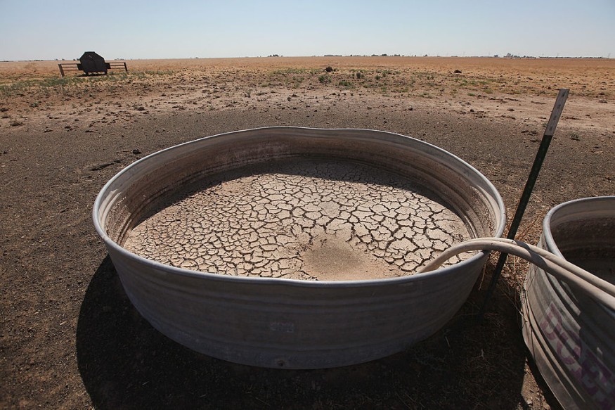
Lately, much of the monsoon moisture has been concentrated over Colorado, New Mexico, and southeastern Utah. Many regions further West have gotten little if any, rain. The sun's energy is not required to evaporate moisture when the ground is dry. Instead, the earth is rapidly heated, resulting in greater temperatures.
Rising Temperatures
Temperatures will climb as a 'heat dome' builds over the West this week. Sinking air behind a heat dome causes temperatures to rise, and precipitation and cloud cover are typically restricted.
Las Vegas is one city that will continue to be under the heat dome. The last time Las Vegas saw measurable rain was on March 28, when 0.1 inch fell. According to the National Weather Service, Las Vegas is on record for its second-driest start to the year. This lengthy period of dryness will allow for efficient solar heating, and after reaching 111 degrees Fahrenheit on Monday, temperatures in the low 110s are expected on Tuesday and Wednesday.
People wanting to visit Utah's Zion National Park and Arches National Park should avoid trekking in the afternoon when temperatures are at their highest.
A Smidgen of Rainfall
Monsoonal thunderstorms brought 0.31 inch of rain to Phoenix in late June. However, no significant rain has fallen, and the ground remains dry. Temperatures above 110 degrees began on Friday and are expected to stay above that threshold every day this week. On Monday, Phoenix hit 115 degrees, 8 degrees more than the day's normal. However, owing to the city's Cool Pavement Program, which tries to lessen the severity of the urban heat island effect, temperatures in some Phoenix districts were a few degrees lower.
Despite the forecast high temperatures, daily highs are unlikely to be broken.
"Record temperatures may be difficult to come by for many spots because it is already a hot time of year," AccuWeather Meteorologist La Troy Thornton stated.
The heat will remain in Phoenix this week, with highs projected to exceed 110 degrees Fahrenheit every day until at least Saturday.
Peaking Heat
The heat will peak later in Salt Lake City as the heat dome moves northward this week. Salt Lake City hit 100 degrees for the fourth time this month and the third time in a row on Sunday.
Because normals and records in Salt Lake City are not as high as in the Desert Southwest, this might be an exception to records being out of reach. On Saturday, Salt Lake City broke the former daily record high of 102 degrees Fahrenheit established in 1994.
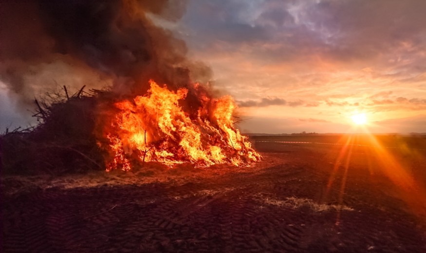
Because of the lack of moisture, monsoonal thunderstorms will be scarce outside New Mexico. Because of the low levels of moisture, any thunderstorms that form may produce more lightning than rain. Dry thunderstorms occur when most or all of the rain from the clouds evaporates before reaching the ground, and lightning from the storm may cause fires in the arid environment.
Thunderstorms should be concentrated at the border of the heat dome.
"By the middle of the week, the monsoon moisture will migrate west and feed scattered thunderstorms throughout the mountains of Nevada and California," said AccuWeather Senior Meteorologist Mike LeSeney.
Weather Forecast
The heat will also be in place further east into Texas. On Monday, temperatures topped the century level almost everywhere in the state. Austin, Texas, is expected to see some of the hottest weather, with highs of 104 degrees Fahrenheit expected Tuesday and Wednesday.
Houston, which normally has cooler temperatures owing to the Gulf of Mexico's impact, hit 101 degrees Fahrenheit on Monday. Tuesday and Wednesday are forecast highs in the upper 90s to around 100 degrees.acc
Temperatures may not fall until the following weekend as the heat dome begins to weaken and travel eastward.
Related Article : Texas Deer Struggles to Grow Antlers Due to Extreme Heat
For similar news, don't forget to follow Nature World News!
© 2026 NatureWorldNews.com All rights reserved. Do not reproduce without permission.


