Between 1960 and 2016, flooding in urban areas charge Americans over $106 billion in lost profits due to property damage, business interruption, and fatalities.
It can be expensive and difficult to determine which areas are also most likely to flood given the constantly shifting land use, shifting rainfall patterns, and shifting climatic conditions.
Additionally, previous methods of creating flood maps have failed to account for the uncertainty in flood forecasting.
Upgraded Flood maps
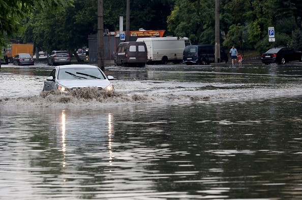
OLEKSANDR GIMANOV/AFP via Getty Images
A new study conducted by the University of Georgia describes a straightforward, economical technique for creating flood maps that take into account the unpredictability of flood predictions, as per ScienceDaily.
The study, which was published in the journal Water, did lead by engineering professor Brian Bledsoe, director of the University of Georgia's Institute for Resilient Infrastructure Systems (IRIS), as well as Tim Stephens, a former IRIS and UGA student who is currently with the engineering, planning, and research company Dynamic Solutions LLC, which focuses on water resources.
In their novel method, Bledsoe and Stephens use the idea of confidence intervals, that also display the standard deviation around a given prediction, to help make clear the flooding risk that homeowners in any given location are exposed to.
Because it takes the variety of possible flooding situations for any provided spot on the map, this method varies from conventional flood maps.
We define the full range of areas where flooding is probable to appear and quantify the uncertainty surrounding flood lines using cutting-edge tools.
The flood zone does have confidence intervals surrounding it, similar to confidence intervals determined by the standard deviation in statistics, and we expose that variability to aid in making plans and decisions to protect people and property.
According to Bledsoe, the unpredictability may be 100 feet in diameter in some places and more than 1,000 feet in diameter in other locations along the floodplain.
Stephens and Bledsoe keep hoping that their method will result in maps that describe the major flood zones with much less effort and expense than earlier approaches. They think their approach should lead to better, more frequently updated maps.
The most frequent natural hazard, flooding results in significant morbidity and mortality, property, and livelihoods on a global scale, as per Flood Resilience Portal.
As extreme weather becomes more frequent and unpredictable due to climate change, and as a result of urbanization and poor land-use planning, people are moving into flood-prone areas, the issue will only get worse.
Flood managing risk and reduced risk depend heavily on flood mapping. The loss and harm brought on by floods are reduced with the aid of flood mapping.
If you are aware of the areas that are most vulnerable to flooding, you can decide not to construct critical infrastructure, such as hospitals, there.
Flood maps are crucial for risk communication because they increase people's propensity to find out information about how to protect themselves and to take alerts and warnings seriously if they are aware that they live in a flood-prone area.
In establishing and enforcing zoning, land use, and building standards, plan and build transportation infrastructure networks, and for flood warning, evacuation, and emergency management and planning, flood maps or flood mapping workouts are essential.
Flood maps are useful for helping communities and individuals know the risk they encounter and plan accordingly. Online flood risk maps are available from many governments, and some of them are updated frequently. Search engines can be used to find local maps.
Exercises in flood mapping that are conducted with or by communities can yield useful information and, for instance, pinpoint safe evacuation routes, ideal spots for evacuation centers, and locals who are especially vulnerable to flooding.
You can find a variety of helpful mapping exercises for comprehending and reducing community flood risk in the resources listed below.