New Zealand's Met Service issued severe weather warnings that will take effect until Wednesday, June 29.
Under the warnings, heavy rain is expected in some parts of the upper South Island and Northland.
Meanwhile, heavy snow is anticipated in the Canterbury High Country and north of Rakaia river.
A front is reportedly causing the inclement weather since Monday, June 27, in South Island, causing the issuance of a "Heavy Rain Watch" and a "Heavy Snow Watch" in the mentioned areas.
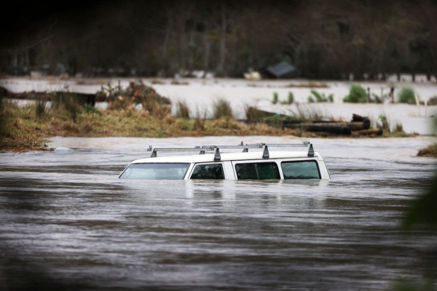
Torrential rain can lead to flash flooding.
Furthermore, heavy snowfall could cause disruption to both land and air travel due to the accumulation of thick snow and poor road visibility.
Severe Weather Warnings
As of Tuesday afternoon, June 28, the severe weather warnings are still in place in the website of the Met Service.
For the Heavy Rain Watch, the following areas are affected:
- Northland
- Marlborough Sounds
- Rai Valley
- Richmond Range
- Westland
- North of Otira
- Buller south of Karamea
Flash flooding is possible in low-lying lands, as well as in communities near lakes and rivers.
The Met Service reminded that snow accumulation could reach 400 meters, while rainfall accumulation to be above 500 meters.
New Zealand Flooding Incidents
New Zealand is no stranger to torrential and flooding, which have been evident across the country last year and even the preceding years, as compiled by Floodlist.com, a natural disaster monitoring site.
Below are some of the instances where the Oceania country experienced severe weather:
In August 2021, heavy rainfall of up to 90 millimeters fell in northern New Zealand in only a span of one hour, forcing dozens of families to evacuate and leave their homes.
In July 2021, severe flooding ravaged the homes of hundreds of people in the Marlborough Region, causing local authorities to declare a state of emergency.
In November 2020, the city of Napier in the Hawkes Bay Region recorded its all-time high rainfall which caused flash flooding in a single hour.
In March 2019, authorities declared a state of emergency after heavy rain and flooding destroyed a bridge and several roads, as well as submerging houses in South Island.
New Zealand Severe Thunderstorms
The latest Met Service forecast has no warnings pertaining to severe thunderstorms.
However, the occurrence of such adverse weather is possible during this period of the year in New Zealand, which is currently in its winter season from June to August.
In early June, the meteorological agency recorded over 18,000 lightning strikes in a single weekend.
It placed 42 storm warnings and storm watches across the country, where tornadoes, damaging winds, snow, large hail, and winter storms do occur.
The Canberra Times also reported the occurrence of more than 100,000 lightning strikes amid a severe weather nationwide during the said period.
Severe thunderstorms naturally produce tornadoes aside from lightning bolts.
The weather phenomenon does occur in New Zealand.
In Kapiti Coast, at least two tornadoes hit the town of Waikanae, leaving a trail of destruction more than two weeks ago.
© 2025 NatureWorldNews.com All rights reserved. Do not reproduce without permission.


