Two weather disturbances or a tropical wave have been spotted over the northern Gulf and the Atlantic Ocean as of Sunday, June 26.
This poses a threat to form at least as a tropical depression and affect areas in the North Atlantic, Gulf of Mexico, and the Caribbean Sea regions, according to a warning issued by the National Hurricane Center (NHC) in Miami, Florida.
The US hurricane agency is monitoring the storm system, which reportedly came from Africa and is traversing off the coast of northern South America.
While the system has been forecasted not to intensify into a hurricane, the NHC said that the tropical wave has a high chance of forming into a more compact storm from early to mid-week.
The agency formed its prediction after observing that the system 1,000 miles off the Windward Islands has continued to show indications of organization rather than a loose weather phenomenon.
Heavy rain, flash flooding, and damaging winds are expected in the affect areas in the coming days.
The Atlantic hurricane season was officially announced to start from June 1 and last until November 30 this year, according to the NHC, a part of the National Oceanic and Atmospheric Administration (NOAA).
The affected countries are those situated above the Atlantic basin, which includes the mentioned regions earlier.
Tropical Depression Forecast
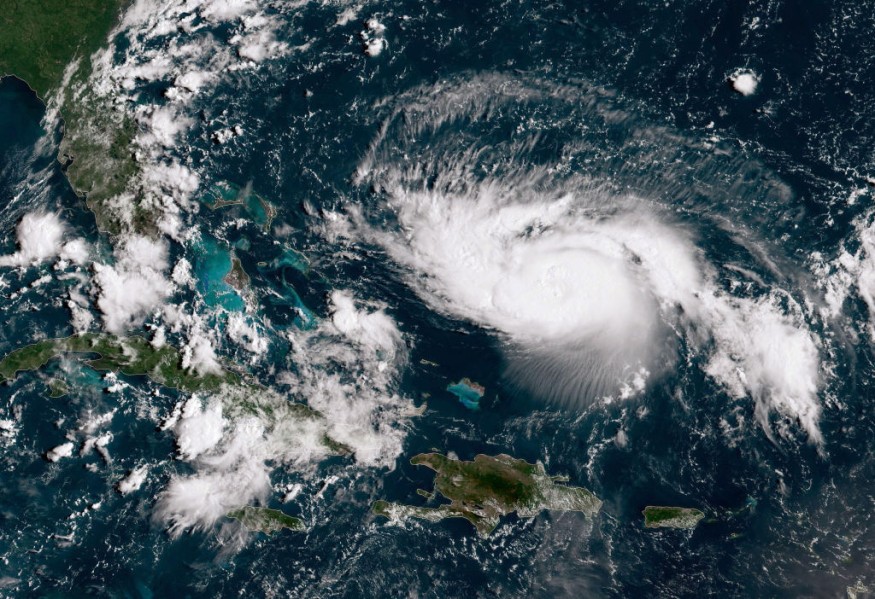
Moving at a speed of 15 to 20 miles per hour, the system is navigating in a northwestward pattern over the tropical part of the Atlantic Ocean near the equator.
From here, it is anticipated to amass strength and grow into a larger weather disturbance with a more organized structure and composition.
Weather forecasters said that "environmental conditions" seemed to be in favor for the further development of the system into a tropical depression, approximately from Monday to Wednesday, June 27 to June 29, as cited by local news Fox 8 Live.
The US media outlet cited the NHC's forecast that the Gulf system has only a 20% chance to form in the next five days, meanwhile the Atlantic system has a 70% chance to form this week.
Should the storm over the Atlantic intensify, it will be named Tropical Storm Bonnie.
Atlantic Tropical Weather Outlook
As mentioned earlier, the NHC issued a warning regarding the weather disturbance.
However, it specifically placed areas in the central tropical Atlantic and northern Gulf of Mexico to be at risk of isolated showers and thunderstorms brought by the system.
This also equates to potential flash flooding, especially in low-lying lands and coastal areas in the region.
Landslides and mudslides are also possible in mountainous areas.
The heavy rain and severe weather is likely in the following countries or areas:
- Southern US
- Mexico
- Cuba
- Haiti
- Dominican Republic
- Northern Venezuela
- Northern Cambodia
- Guatemala
- Nicaragua
Based on NHC's tropical cyclone climatology, there are four levels which a tropical cyclones goes through, with tropical depression being the weakest. It is followed by tropical storm, hurricane.
A "major hurricane" is the strongest among the storm categories.
© 2026 NatureWorldNews.com All rights reserved. Do not reproduce without permission.


