A spring Nor'easter struck the Northeast US, notably affecting the states of New York and Pennsylvania.
Hundreds of thousands of customers experienced power outages as the storm brings heavy snow, knocking out or damaging power lines, as well as leading to the closure of businesses and schools.
Blackouts and Disruption
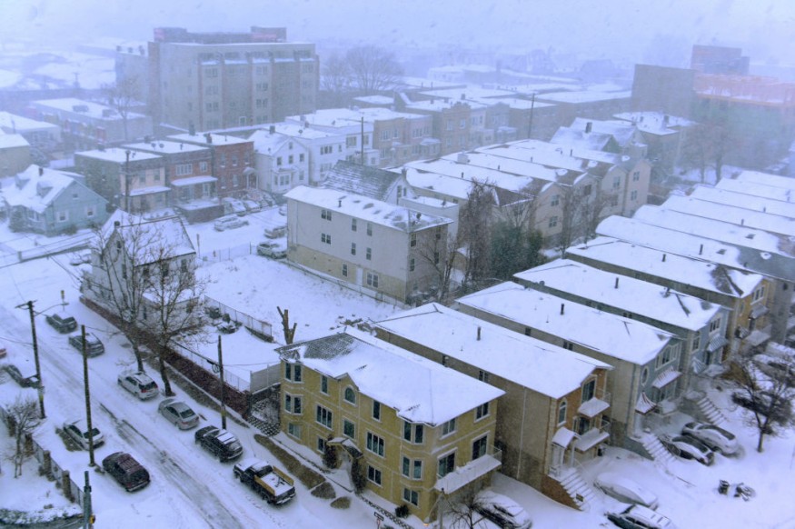
At least a foot of snow accumulated in New York and Pennsylvania where a total of more than 200,000 customers were left without electricity as of Tuesday afternoon, April 19, via the utility monitoring site Power Outage US.
There are approximately 160,000 outages reported in New York and 40,000 in Pennsylvania.
In New York, 18 inches of snow were reported in the upstate area of Virgil, 16 inches of snowflakes also buried Indian Lake, and at least a foot of snow was recorded in the northern-western areas of Albany, as per NBC News.
Broome County officials implemented a travel ban after Binghamton received a record-breaking 14.2 inches of snow, as part of April's largest snowstorm.
In addition, Syracuse closed some of its commercial and educational establishments due to rapid snowfall and a lack of power supply.
This is due to "heavy, wet snow" falling at a rate of one to two inches per hour across upstate New York, said the local US media outlet.
In Pennsylvania, the Nor'easter caused a heavy downpour of 16 inches of snow in New Milford and other communities across the state.
Despite the renewed winter storm in the region, there were no immediate reports of casualties.
Also Read: Nor'easter Snow Storm: 6 up to 40 inches of snow, 18 Counties Declared Under State of Emergency
Late Season Nor'easter
The National Oceanic and Atmospheric Administration (NOAA) - National Weather (NWS) stated that the Nor'easter will continue to generate light snow along with gusty winds in the Northeast until Tuesday evening.
The US weather agency's Weather Prediction Center (WPC) emphasized that between three and six inches of snow accumulations will affect northern Pennsylvania and the Adirondacks.
Moreover, over eight inches of snow may accumulate in Lake Erie in southwestern New York.
Additional US Weather Forecast
The NOAA - NWS has also issued its latest weather forecast valid from Wednesday to Friday, April 20 to April 22, highlighting the arrival of stormy weather in the Pacific Northwest from mid-week, mountain snow in the Northwest, and the "Critical Risk" of fire weather in the Southwest and Southern Plains.
A mixture of "Freeze Warnings" and "Frost Advisories" was reportedly issued in the Mid-Atlantic and Ohio Valley.
In the Southwest and the High Plains, the WPC fire weather warnings were issued between Arizona, Las Vegas, and New Mexico, stating that fire weather hazards are caused by dry fuels, gusty winds, and low humidity.
"Red Flag Warnings" are also in place for western Nebraska, eastern Wyoming, and central-southern New Mexico for Wednesday.
Lastly, summer-like temperatures are expected to be felt in the Great Plains on Wednesday and the Mississippi Valley until Thursday, April 21.
Since the US entered its spring season, several weather events related to the January-like winter storm phenomenon have occurred across the country, similar to its previous winter season that started in December.
© 2026 NatureWorldNews.com All rights reserved. Do not reproduce without permission.


