According to experts, a massive shift in the weather is occurring in the country's middle this week, as air flowing down from the Arctic threatens to bring substantial temperature reversals. At the same time, a storm delivers heavy snow from the Rockies to the Great Lakes.
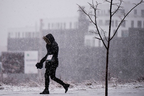
The weather was almost springlike only a few days ago, which will be more typical of January for the rest of the week throughout sections of the central and southern Plains.
Arctic Air Incoming
Arctic air is anticipated to descend over the northern Plains by the middle of the week, with temperatures as much as 20 degrees Fahrenheit below average for mid-March by Thursday afternoon.
In Minneapolis, where the average high temperature for March 10 is 37 degrees, a high of 25 degrees is forecast for Thursday. Meanwhile, the high temperature in Fargo, North Dakota, is forecast to reach 20, although the typical high temperature is 33 degrees.
So far in March, temperatures in these cities have averaged below normal. Fargo was 3.9 degrees below average after the first eight days of the month.
Further south, Dallas has already seen one 30-degree temperature drop this week, with a drop from highs over 80 this past weekend to a high of barely 52 on Monday. The city is one of many that is seeing a temperature swing.
Temperature Shift
According to AccuWeather Senior Forecaster Alex Sosnowski, temperatures in Dallas are expected to rise to about 60 degrees on Wednesday and near 70 degrees on Thursday before plummeting again by Friday. On Friday, temperatures will be in the 30s for the majority of the day, with a combination of rain, sleet, and snow in the forecast, followed by a freeze-up Friday night.
The average high for March 11 is 67 degrees in Dallas, while the average low is 47 degrees.
The erratic weather isn't unusual for March, which is frequently a battleground between the closing days of winter and the entrance of spring.
"Temperature swings may happen any month of the year, but March may be the best since the air is typically quite cold in Canada, and the sun can generate very warm circumstances in the United States," Sosnowski said. "A simple change in wind direction from south to north, or vice versa, can result in significant temperature fluctuations of 20, 30, 40, or more degrees from one day to the next."
This surge of cold will shock the system in some other places. At the start of March, temperatures in Sioux Falls and Rapid City, South Dakota, climbed to 20 degrees above usual. By Thursday, afternoon temperatures are expected to be about 20 degrees below average.
As cold, dry weather settles in this part of the country, a storm is forecast to ride along the cold's southern edge, bringing snow from the Rockies to the Midwest. 3-6 inches of new snow will fall in Denver and 1-3 inches in Salt Lake City.
While the largest snowfall totals are expected in the Rockies, several inches of snow might fall in South Dakota and Nebraska and Iowa, southern Minnesota, and Wisconsin on Thursday. This blanket of snow may make driving on Interstate 80 treacherous, especially in Des Moines, where residents are still cleaning up after tornadoes wreaked havoc on the city less than a week ago.
This coming storm system may bring anywhere from 4 to 8 inches of snow to Kansas City, Missouri. Due to a southerly change in the current prediction, Chicago will only get a dusting to an inch of snow, while Milwaukee will get little to no precipitation from Thursday night through Friday.
At the end of the week, colder weather is forecast to arrive in this area.
Clear Skies
Clear skies are expected to follow the chilly air flowing in from Canada, lowering temperatures even further on Thursday night. According to Meteorologist Brandon Buckingham, certain locations across the North Central states might be flirting with record low temperatures by Friday morning.
Temperatures in Colorado Springs and Denver, Colorado, Omaha, Nebraska, and Minneapolis, are expected to be in the single digits Friday morning, while temperatures in other locations, such as Fargo, North Dakota, might be below zero. Low temperatures can drop to 5-10 degrees below zero in the northern High Plains and east of the Front Range. These kinds of temperatures are more common in January.
According to AccuWeather Lead Long-Range Meteorologist Paul Pastelok, the midweek blizzard is likely to assist these temperatures to materialize.
For those who despise the cold, though, there is some good news on the way. According to experts, temperatures in the eastern part of the United States are expected to moderate by next week.
According to Pastelok, this substantial cold spell will be temporary, as warmth is forecast to occur for the Plains and locations farther east.
For more climate and weather updates, don't forget to follow Nature World News!
© 2026 NatureWorldNews.com All rights reserved. Do not reproduce without permission.


