Below average temperature is headed toward west of Denver as wave of cold air in the Rocky Mountains send fresh snowfall in Salt Lake City, days after a "springlike" warmth.
Conditions across the region will turn mostly cloudy Tuesday with mild temperatures in the 30s and 40s, and a snowstorm for Wednesday evening is forecasted.
"The Denver area will be caught between a storm moving out of the Southwest and a high pressure surging southward across the northern Plains," AccuWeather Senior Meteorologist Michael LeSeney explains, as the storm draws moisture northward into the southern Plains.
By the time it crosses, temperatures are predicted to trend downward, delivering widespread snow across the region.
"As cold, arctic air presses southward across Wyoming and Colorado, an easterly wind will draw upon that moisture in the southern Plains and push it up into the Rocky Mountains," LeSeney added.
Denver weather forecast
Forecasters say snow will spread in a southeasterly direction on Tuesday night and over portions of Utah, Idaho, Nevada and Wyoming. A mix of rain and snow will also start in places like Salt Lake City before it overspreads the mountains in Colorado early Wednesday.
As per the local news Fox31, nearly 15 degrees above average will be felt on Tuesday, as snow moves in Wednesday subsequently.
The Pinpoint Weather Team had issued a Pinpoint Weather Alert Day ahead of Wednesday's snowstorm and forecasted how much snowfall is expected: snow in Central and Northern Mountains starts early Wednesday; Northern Colorado starts 7 a.m. or later; 12 p.m. in both Boulder and Denver; and 12 p.m. or later in Castle Rock.
"As this cold, moist air flows up the slope of the Rockies, it will produce widespread snow across eastern Colorado and will bring several inches of snow to the cities and communities along the Front Range from Fort Collins, Colorado, in the north to Colorado Springs, Colorado, in the south," LeSeney said.
How to prepare for Wednesday's snowstorm
Fox31 reports things to know about the next round of snow after last week's storm. It will arrive in the mountains by Wednesday morning and in Denver by around 12 p.m, sending temperatures at or below freezing, and will continue until around midnight before it ends in the Mile High City. A a total of about 3 inches is expected by the time it's all said and done.
Additionally, the Wednesday evening commute appears to be the biggest impact to travel for Denver. The local news also forecasted the projected snowfall totals for this storm.
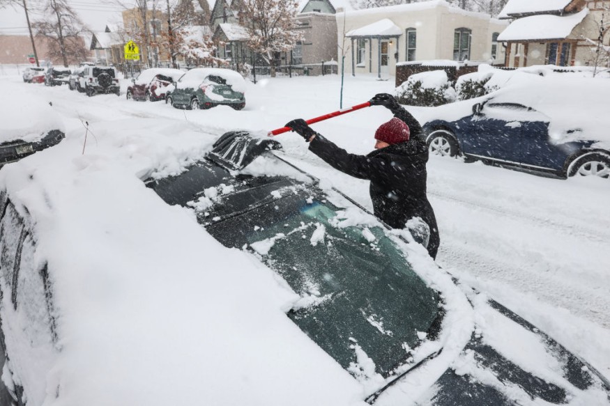
As snow accumulates, it is likely to cause slippery road conditions, reduce visibilities, and create travel delays across the West. Motorists traveling on interstates 15, 25, 70, 76, 80, 84 and 86 are recommended to "slow down and avoid unnecessary travel" during the storm.
The return of harsh winter cold in Denver after last week's high temperatures "could feel even colder" with AccuWeather RealFeel® Temperatures in the upper 20s. According to the National Weather Service, "this bitter cold will be most significant during the overnight hours, but it will stay quite cold during the daytime."
© 2025 NatureWorldNews.com All rights reserved. Do not reproduce without permission.


