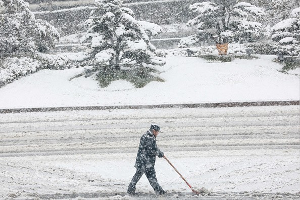
A weak weather system developing along a powerful cold front may bring snow showers, flurries, and also light accumulation to some parts of Mid-Atlantic on Sunday.

Low Temperatures Expected in the Wake of the Cold front
On Saturday night, an upper-level trough will move eastward from the Great Lakes through the lower Mississippi Valley, eventually reaching the Mid-Atlantic on Sunday.
Temperatures are expected to drop significantly over the weekend and into the first few days of the new week after the cold front.
Due to the lack of heavy snowfall forecast, considerable travel disruptions are not expected. Even a thin layer of snow on untreated surfaces can be hazardous, therefore people are advised to take caution when driving in the winter.
The sharpening baroclinic zone off the southern Mid-Atlantic coast is expected to produce a low pressure area late Saturday night and early Sunday, which could lead to some wintry precipitation. There will be little precipitation on land due to a progressive flow across the region and a surface low moving well offshore.
Also Read : More Than 100 Million US Residents Under Cold Weather Warnings as a Result of Low Temperatures
Areas to Experience Snow Showers, Flurries, and Light Accumulation
More snowfall is conceivable if the system intensifies or moves closer to the shore, but the chances of that happening right now are slim.
All of Virginia, Maryland, Delaware, Rhode Island, and New Jersey, easternmost Pennsylvania, southeastern New York, and the southeastern regions of Connecticut and Massachusetts are at risk of snow showers and flurries.
Precipitation showers and flurries are expected to begin Saturday night and continue through Sunday morning, with the light snow expected to leave the region by Sunday lunchtime. The ground could be covered with a light dusting of snow if a few flurries fall.
Some areas of Virginia, Maryland, Delaware, New Jersey, Long Island, Rhode Island, and southeastern Massachusetts may see snow accumulations more than a dusting, but this is unlikely.

Dry Conditions May Take Over by Sunday Evening
Snowfall of up to a half-inch or so is possible if some isolated 3-4′′ amounts fall in western Virginia, this will be a minor, low-impact snow event for the eastern United States.
Pecipitation is expected to leave by Sunday afternoon, with dry conditions spreading across the region by Sunday night.
During a cold air outbreak, lake-effect events can dump a lot of snow in a short period of time on unwary places downwind. A surprise strike on the Great Lakes could be foiled by flurries.
It is not uncommon to be driving downwind of the lake coast in clear circumstances, then minutes later a few snowflakes might suddenly morph into a furious snowstorm with snow-covered roadways. After a few dozen miles, the snow bands tend to diminish their intensity, but they can still produce unexpected, abrupt snowfall further inland.
Related Article : Blizzard Warning! Winter Storm, Bomb Cyclone Causes Canceled Flights, Power Outages Across the US
For more news, updates about cold front and similar topics don't forget to follow Nature World News!
© 2026 NatureWorldNews.com All rights reserved. Do not reproduce without permission.


