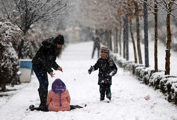
The onslaught of storms that have pounded the western United States has caused problems for visitors and residents. Still, it has also proven to be quite helpful in accumulating a significant snowpack across the region's mountain ranges. The chilly and unpredictable weather pattern is predicted to persist until the final week of 2021.
So far this autumn and winter, the rainy pattern across California has been a boon for alleviating drought fears, with the whole Sierra Nevada Mountain Range presently running above historical snowfall norms. As the calendar moves to 2022, those numbers will continue to grow due to persistently frigid weather entrenched over the mountains.
Water Levels
Reservoir levels in California's lower terrain and foothills have also increased as severe weather has pushed water levels higher.
Most basins in Washington's Cascade Mountain Range are within 10-20 percent of their historical snow water equivalent at this stage in the season.
While the continually unstable weather has helped the mountain ranges, it has also caused a slew of weather-related problems for those living at lower elevations.
Rain in LA and SF
So far this month, both Los Angeles and San Francisco have had roughly 200 percent of normal rainfall, resulting in flash flooding and travel problems. San Francisco has seen 14 days with measurable precipitation, totaling 8.57 inches, as of Dec. 25.
Places like Flagstaff, Arizona, and Phoenix, Arizona, have also seen their fair share of rain, with both towns receiving an inch or more of precipitation on Christmas Eve.
There's more on the way across the West, so stay tuned.
Early this week, record-breaking cold weather will continue to blanket the Northwest, resulting in record-low snow levels. Snow was recorded down to sea level in several areas of Washington on Sunday morning.
During the pre-dawn hours of Sunday, heavy snow was recorded in the Seattle metropolitan area, and snow persisted for the rest of the day.
Related Article : Intense Snowstorm Closed Down a 111-Mile Stretch of California Highway
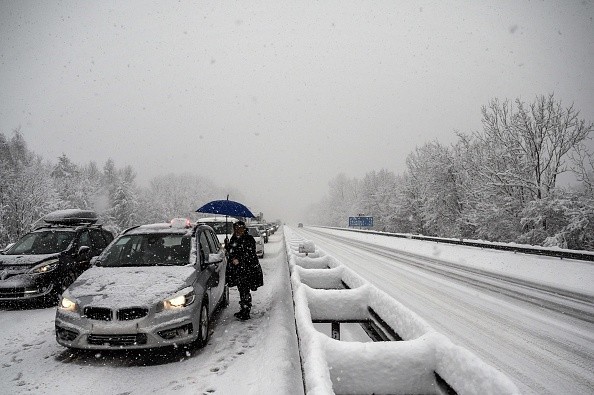
Travel Delays
On Sunday, Seattle-Tacoma International Airport operations were severely hampered by snow. More than 360 flight delays and almost 290 cancellations were recorded at one point on Sunday afternoon as personnel worked around the clock to clear runways and deice planes.
"On Sunday, snow totals in the Seattle region were on the order of 2-4 inches, with northern locations seeing locally greater accumulations," AccuWeather Meteorologist Mary Gilbert said.
The Emerald City receives about 6.8 inches of snow each year on average.
Another storm might bring more snowflakes Wednesday night through Thursday night, but the warmer air will likely restrict any accumulations in the city.
A similar snowy image is likely to persist throughout the Interstate 5 corridor from Washington to Oregon and Northern California.
Early this week, when the storm moves south, another wave of heavy snow will rush into California's rugged terrain, piling up feet of snow throughout the Sierra Nevada. Most mountain pass routes, including Donner, Echo, Carson, Sonora, and Tioga passes, will have highly challenging, if not impossible, travel conditions.
"The heavy snow will continue to create travel and logistical challenges across the passes," AccuWeather Senior Meteorologist Tyler Roys explained. "This will lead to another round of pass closures and the need for chains on most vehicles, including those returning from the holidays or traveling to the ski resorts."
Snow Levels
Snow levels will drop over Central and Northern California during the day on Monday, from roughly 2,000 feet to as low as a few hundred feet by Monday night, making driving hazardous on roads that aren't used to dealing with icy weather.
While the Sierra Nevada will see the most snow on Monday, wintry weather will not be restricted to areas bordering the Pacific Ocean. A jet of precipitation will sweep through the Intermountain West, bringing snow to regions like Idaho's Snake River Valley, Salt Lake City, and western Wyoming's hilly terrain.
Winter Storm Trajectory

The storm will have moved southeastward towards the Four Corners Region by Monday night. Before things quickly ease down by midweek, the high terrain of Utah's southern Wasatch Range, Arizona's Grand Canyon and Mogollan Rim, and New Mexico's Colorado Plateau and Sangro de Cristo Mountains may all expect a fresh coating of snow.
This storm won't be the only one causing havoc in the West, as the busy pattern will continue on Tuesday with another storm heading into Oregon and California. With the cold air in situ, snow levels are pretty low.
While the cold and snowy pattern will make skiers happy, the new powder will also bring hidden threats. As a result of the rounds of snowfall throughout the steep terrain, there is a significant risk of avalanches. This risk is hazardous for thrill-seekers who want to venture out into the backcountry, and necessary measures should be taken.
The storm that is expected to bring another round of wet and snowy weather to California and the Southwest from midweek to the upcoming weekend is expected to pivot southward along the West Coast, posing a new threat of flooding in the lower terrain as well as feet of snow in the mountainous terrain. Furthermore, between Thursday and Friday, another storm is forecast to bring rain and snow to the Northwest.
For more news about the environment , don't forget to follow Nature World News!
© 2025 NatureWorldNews.com All rights reserved. Do not reproduce without permission.


