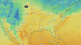
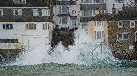
There are presently two powerful typhoons heading over the Pacific and Atlantic seas. The blizzards are post-tropical cyclone Ema and hurricane Melissa. Neither represents a tremendous compromise; however, weather stations are following six other tropical systems that are viewed as liable in strengthening the storms.
Atlantic Ocean
There are currently three tropical systems being monitored by the National Oceanic and Atmospheric Administration (NOAA) in the Atlantic Ocean.
The first system being monitored is a low-pressure area located over the far eastern tropical Atlantic Ocean, near southwest of Cabo Verde Islands, and is slowly moving west-northwestward.
The NOAA said that strong winds should limit any further progress by midweek. The forecast would bring intense heavy rainfall to portions of Cabo Verde Islands with the chance of formation in 48 hours and five days is high at 80 percent.
The system involves showers and thunderstorms and exhibiting some signs of formation. Environmental conditions are expected to form a tropical depression in the next 48 hours as the disturbance moves west-northwestward to northwestward near the Cabo Verde Islands.
The second system being monitored in the Atlantic Ocean is a mark of scattered showers and thunderstorms over parts of Central America, the Gulf of Honduras, and the southwestern Carribean Sea. The weather disturbance is linked with the low-pressure area located near north-central Honduras.
The movement is expected to move toward the west-northwestward part of Honduras, northern Guatemala, and southern Belize. It is expected to prevent the formation of tropical cyclones for the following days.
The potential storm is forecasted to appear in the southern Bay of Campeche on Wednesday. The conditions may serve as an opportunity for
The potential storm is expected to emerge in the southern Bay of Campeche on Wednesday. The weather conditions could serve as an opportunity for the storm to develop.
The third disturbance being monitored by the weather systems is located across the central tropical Atlantic, which is producing scattered clouds and thunderstorms.
A tropical wave caused the issues to blow up, and thunderstorm activity has increased. It is expected to approach the Winward Islands by Wednesday and is moving westward at 15 miles per hour. However, the chance of formation within 48 hours or five days is only at 10 percent.
East Pacific Ocean
There are additionally two tropical disturbances being monitored by the Pacific Disaster Center in the East Pacific Ocean, too.
The first system involves scattered showers and thunderstorms over portions of western Mexico, Gulf of California, and Baja California Sur. These are linked with the area of low pressure in the area.
The chance of formation through 48 hours or five days is estimated at near zero percent. It means the development is unlikely as the low-pressure area moved to calmer waters. However, the rainfall linked with the system will continue to hit portions of northern Sinaloa, southern Sonora, and Baja California Sur.
The second system involves scattered showers and thunderstorms over the eastern North Pacific, where a low-pressure area was seen miles south Guatemala coast. Gradual development is expected.
A tropical depression is expected to develop as a weather disturbance is seen moving 10 miles per hour west-northwestward near the coast of Mexico. The chance of development of a storm is at 50 percent in the next five days.
A tropical depression is likely to form within the next few days while the system moves west-northwestward at about 10mph near or just offshore the coast of Mexico. It could inhibit further development later this week.
Fiji
There is a tropical disturbance located near Fiji, according to Fiji Meteorological Service. However, the system is moving very slow and has no intensification. It can be found in a slightly sheered environment. The chance of developing into a tropical cyclone in the next 24 to 48 hours is very low.
© 2024 NatureWorldNews.com All rights reserved. Do not reproduce without permission.

![Severe Thunderstorm Alert: Tornadoes, Damaging Winds and Hail Possible from Upper Ohio Valley to Northeast US [NWS]](https://1471793142.rsc.cdn77.org/data/thumbs/full/70161/280/157/50/40/severe-thunderstorm-alert-tornadoes-damaging-winds-and-hail-possible-from-upper-ohio-valley-to-northeast-us-nws.jpg)


